
Size of this preview:
800 × 600 pixels. Other resolutions:
320 × 240 pixels |
640 × 480 pixels |
1,024 × 768 pixels.
Original file (1,024 × 768 pixels, file size: 319 KB, MIME type: image/jpeg)
| This is a file from the
Wikimedia Commons. Information from its
description page there is shown below. Commons is a freely licensed media file repository. You can help. |
|
This is an image of a place or building that is listed on the
National Register of Historic Places in the
United States of America. Its reference number is
80003418. |
| Camera location |
| View this and other nearby images on: OpenStreetMap |
|
|---|
| Description |
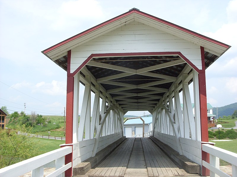
English: Western end of the
Halls Mill Covered Bridge, located north of
Everett in
Hopewell Township,
Bedford County,
Pennsylvania,
United States. Built in 1872, this Burr truss covered bridge is listed on the
National Register of Historic Places. |
| Date | |
| Source | Flickr |
| Author | dougtone |
| Permission ( Reusing this file) |
This file is licensed under the
Creative Commons
Attribution-Share Alike 2.0 Generic license.
|
| This image was originally posted to Flickr by dougtone at https://www.flickr.com/photos/7327243@N05/4183873843. It was reviewed on 20 December 2009 by FlickreviewR and was confirmed to be licensed under the terms of the cc-by-sa-2.0. |
File history
Click on a date/time to view the file as it appeared at that time.
| Date/Time | Thumbnail | Dimensions | User | Comment | |
|---|---|---|---|---|---|
| current | 19:30, 19 December 2009 |
| 1,024 × 768 (319 KB) | Nyttend | {{Location|40|7|27|N|78|19|2|W}} {{Information |Description={{en|One end of the {{w|Halls Mill Covered Bridge}}, located north of {{w|Everett, Pennsylvania|Everett}} in {{w|Hopewell Township, Bedford County, Pennsylvania|Hopewell Township}}, {{w|Bedford C |
File usage
The following pages on the English Wikipedia use this file (pages on other projects are not listed):
Global file usage
The following other wikis use this file:
- Usage on tl.wikipedia.org
- Usage on www.wikidata.org