Size of this preview:
800 × 530 pixels. Other resolutions:
320 × 212 pixels |
640 × 424 pixels |
1,024 × 679 pixels |
1,281 × 849 pixels.
Original file (1,281 × 849 pixels, file size: 27 KB, MIME type: image/png)
| This is a file from the
Wikimedia Commons. Information from its
description page there is shown below. Commons is a freely licensed media file repository. You can help. |
Summary
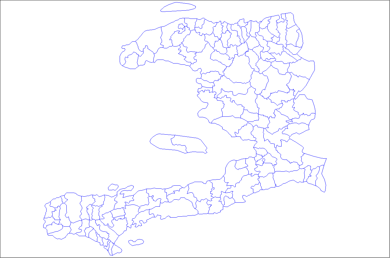
| Description | Map of the communes of Haiti. Created by Rarelibra 21:03, 27 April 2007 (UTC) for public domain use, using MapInfo Professional v8.5 and various mapping resources. |
| Date | 27 April 2007 (original upload date) |
| Source | No machine-readable source provided. Own work assumed (based on copyright claims). |
| Author | No machine-readable author provided. Rarelibra assumed (based on copyright claims). |
Licensing
| I, the copyright holder of this work, release this work into the
public domain. This applies worldwide. In some countries this may not be legally possible; if so: I grant anyone the right to use this work for any purpose, without any conditions, unless such conditions are required by law. |
File history
Click on a date/time to view the file as it appeared at that time.
| Date/Time | Thumbnail | Dimensions | User | Comment | |
|---|---|---|---|---|---|
| current | 21:03, 27 April 2007 |
| 1,281 × 849 (27 KB) | Rarelibra | Map of the communes of Haiti. Created by ~~~~ for public domain use, using MapInfo Professional v8.5 and various mapping resources. |
File usage
More than 100 pages use this file. The following list shows the first 100 pages that use this file only. A full list is available.
- Abricots
- Administrative divisions of Haiti
- Anse-Rouge
- Anse-d'Hainault
- Anse-à-Galets
- Anse-à-Pitres
- Anse d'Hainault Arrondissement
- Aquin Arrondissement
- Arcahaie
- Arrondissements of Haiti
- Artibonite (department)
- Bahon, Haiti
- Baradères
- Beaumont, Haiti
- Belladère
- Bombardopolis
- Bonbon, Haiti
- Borgne
- Boucan-Carré
- Cabaret, Haiti
- Cap-Haïtien
- Carrefour, Haiti
- Cavaillon (Haiti)
- Centre (department)
- Cerca-Carvajal
- Cerca-la-Source
- Chambellan
- Cité Soleil
- Corail, Haiti
- Corail Arrondissement
- Cornillon, Haiti
- Croix-des-Bouquets
- Dame-Marie, Haiti
- Delmas, Haiti
- Departments of Haiti
- Desdunes
- Dessalines
- Dessalines Arrondissement
- Ennery, Artibonite
- Fonds-Verrettes
- Fort-Liberté
- Ganthier
- Gonaïves
- Gonâve Island
- Grand'Anse (department)
- Grand-Goâve
- Grande-Saline, Haiti
- Gros-Morne, Haiti
- Gros-Morne Arrondissement
- Haiti
- Hinche
- Jacmel
- Jérémie
- Jérémie Arrondissement
- Kenscoff
- L'Estère
- La Chapelle, Haiti
- Lascahobas
- Les Cayes
- Les Irois
- List of communes of Haiti
- Léogâne
- Marmelade
- Maïssade
- Milot, Haiti
- Miragoâne
- Mirebalais
- Moron, Haiti
- Môle-Saint-Nicolas
- Navassa Island
- Nippes
- Nord-Est (department)
- Nord-Ouest (department)
- Nord (Haitian department)
- Ouanaminthe
- Ouest (department)
- Pestel, Haiti
- Petit-Goâve
- Petite Rivière de l'Artibonite
- Pointe-à-Raquette
- Port-Salut
- Port-au-Prince
- Port-de-Paix
- Pétion-Ville
- Roseaux
- Saint-Marc
- Saint-Michel-de-l'Atalaye
- Saint-Raphaël, Haiti
- Saut-d'Eau
- Savanette
- Sud-Est (department)
- Sud (department)
- Tabarre
- Terre-Neuve, Haiti
- Thomassique
- Thomazeau
- Thomonde
- Tortuga (Haiti)
- Verrettes
- Île-à-Vache
View more links to this file.
Global file usage
The following other wikis use this file:
- Usage on ar.wikipedia.org
- بورت أو برانس
- فاليرس
- إدارات هايتي
- سان مارك
- إدارة أرتيبونيت
- الإدارة الوسطى (هايتي)
- إدارة آنس الكبرى
- إدارة نيبيس
- الإدارة الشمالية (هايتي)
- الإدارة الشمال شرقية (هايتي)
- الإدارة الشمال غربية (هايتي)
- الإدارة الغربية (هايتي)
- الإدارة الجنوب شرقية (هايتي)
- الإدارة الجنوبية (هايتي)
- دائرة جروس مورن
- دائرة جيريمي
- أنس روج
- أنس هينولت
- دائرة آنس هينولت
- أنس فولير
- ديم ماري
- فوندس فيريتيس
- جراند جوسير
- جزيرة السلاحف (هايتي)
- غوناييف
- هنش
- جيريمي
- ميراغوان
- كاب هايتيان
- فورت ليبرتي
- بورت دي بيه
- جاكميل
- ليس كايس
- أبريكوتس
- آنس فيوي
- بيرتشيس
- كينسكوف
- ليس إرويس
- مانيش (هايتي)
- ميلوت
- بيستيل
- دائرة أكين
- دائرة ليس كايس
- دائرة تشاردونيريس
- دائرة كوتو
- دائرة بولت سالت
- دائرة آنس فيوي
- دائرة ميراغوان
- دائرة كوريل
- دائرة غوناييف
View more global usage of this file.