
Size of this preview:
484 × 599 pixels. Other resolutions:
194 × 240 pixels |
388 × 480 pixels |
620 × 768 pixels |
827 × 1,024 pixels |
1,654 × 2,048 pixels |
4,200 × 5,200 pixels.
Original file (4,200 × 5,200 pixels, file size: 2.95 MB, MIME type: image/jpeg)
| This is a file from the
Wikimedia Commons. Information from its
description page there is shown below. Commons is a freely licensed media file repository. You can help. |
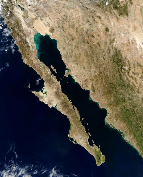
| Description | Baja peninsula (Mexico) 250m, en:Gulf of California | |||||
| Date | November 30, 2003, by the Aqua satellite | |||||
| Source | http://visibleearth.nasa.gov | |||||
| Author | Credit Jacques Descloitres, MODIS Rapid Response Team, NASA/GSFC | |||||
| Permission ( Reusing this file) |
|

File history
Click on a date/time to view the file as it appeared at that time.
| Date/Time | Thumbnail | Dimensions | User | Comment | |
|---|---|---|---|---|---|
| current | 16:21, 5 April 2008 |
| 4,200 × 5,200 (2.95 MB) | Makary | {{Information |Description=Baja peninsula (Mexico) 250m, en:Gulf of California |Source=http://visibleearth.nasa.gov |Date=November 30, 2003, by the Aqua satellite |Author=Credit Jacques Descloitres, MODIS Rapid Response Team, NASA/GSFC |Permission={{PD-US |
File usage
The following pages on the English Wikipedia use this file (pages on other projects are not listed):
Global file usage
The following other wikis use this file:
- Usage on azb.wikipedia.org
- Usage on bn.wikipedia.org
- Usage on en.wikibooks.org
- Usage on es.wikipedia.org
- Usage on fi.wikipedia.org
- Usage on hu.wikipedia.org
- Usage on it.wikipedia.org
- Usage on lt.wikipedia.org
- Usage on ms.wikipedia.org
- Usage on mt.wikipedia.org
- Usage on pl.wikipedia.org
- Usage on pl.wiktionary.org
- Usage on ru.wikipedia.org
- Usage on sk.wikipedia.org
- Usage on sl.wikipedia.org
- Usage on sr.wikipedia.org
- Usage on sw.wikipedia.org
- Usage on vi.wikipedia.org