
Size of this preview:
800 × 400 pixels. Other resolutions:
320 × 160 pixels |
640 × 320 pixels |
1,024 × 512 pixels |
1,280 × 640 pixels |
3,600 × 1,800 pixels.
Original file (3,600 × 1,800 pixels, file size: 1.99 MB, MIME type: image/jpeg)
| This is a file from the
Wikimedia Commons. Information from its
description page there is shown below. Commons is a freely licensed media file repository. You can help. |
Summary
| Description |
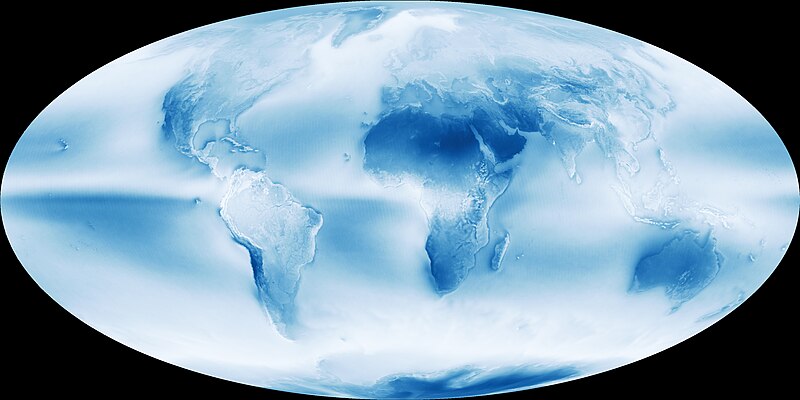
English: NASA Earth Observatory published a map of data collected between July 2002 and April 2015 to give a view of the world’s cloudy and sunny spots. This is an average of the
MODIS images from
AQUA satellite. The darker the color, the clearer the sky. |
| Date | |
| Source | http://earthobservatory.nasa.gov/IOTD/view.php?id=85843 |
| Author | NASA Earth Observatory |
Licensing
| This file is in the public domain in the United States because it was solely created by NASA. NASA copyright policy states that "NASA material is not protected by copyright unless noted". (See Template:PD-USGov, NASA copyright policy page or JPL Image Use Policy.) | ||
 |
Warnings:
|
File history
Click on a date/time to view the file as it appeared at that time.
| Date/Time | Thumbnail | Dimensions | User | Comment | |
|---|---|---|---|---|---|
| current | 16:23, 17 May 2015 |
| 3,600 × 1,800 (1.99 MB) | CuriousMind01 | User created page with UploadWizard |
File usage
The following pages on the English Wikipedia use this file (pages on other projects are not listed):
Global file usage
The following other wikis use this file:
- Usage on ar.wikipedia.org
- Usage on es.wikipedia.org
- Usage on ig.wikipedia.org
- Usage on no.wikipedia.org
- Usage on sr.wikipedia.org
- Usage on ur.wikipedia.org