
Size of this preview:
800 × 525 pixels. Other resolutions:
320 × 210 pixels |
640 × 420 pixels |
1,024 × 672 pixels |
1,280 × 840 pixels |
2,560 × 1,680 pixels |
4,749 × 3,116 pixels.
Original file (4,749 × 3,116 pixels, file size: 3.86 MB, MIME type: image/jpeg)
| This is a file from the
Wikimedia Commons. Information from its
description page there is shown below. Commons is a freely licensed media file repository. You can help. |
|
This is an image of a place or building that is listed on the
National Register of Historic Places in the
United States of America. Its reference number is
79003036. |
| Camera location |
| View this and other nearby images on: OpenStreetMap |
|
|---|
| Description |
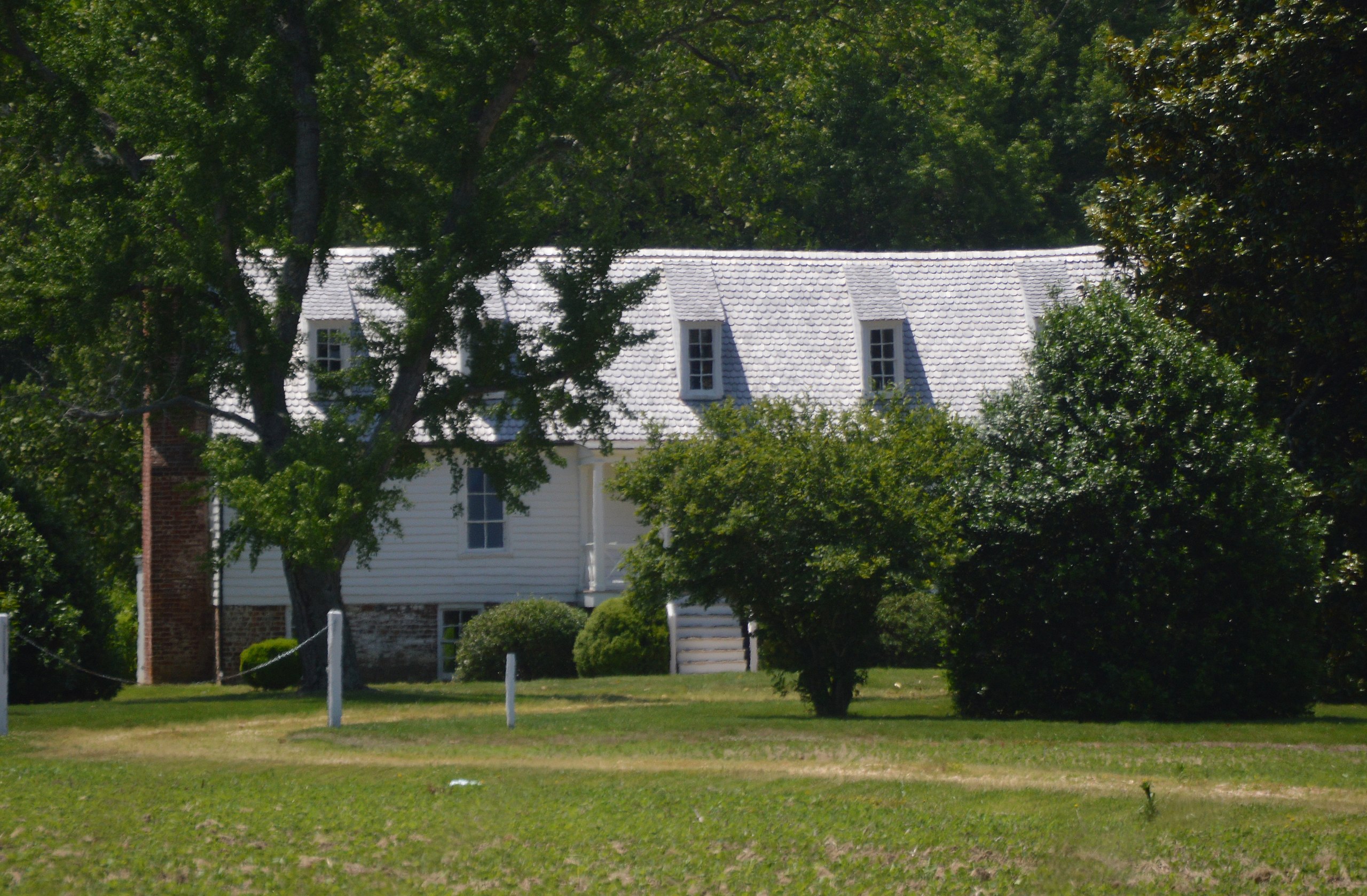
English: Distant view of
Glencairn, located along
U.S. Route 17 east of
Loretto in
Essex County,
Virginia,
United States. Built beginning in 1730, the house is listed on the
National Register of Historic Places. |
||
| Date | Taken on 25 May 2019 | ||
| Source | Own work | ||
| Author | Nyttend | ||
| Permission ( Reusing this file) |
|
||
| Other versions | None |
File history
Click on a date/time to view the file as it appeared at that time.
| Date/Time | Thumbnail | Dimensions | User | Comment | |
|---|---|---|---|---|---|
| current | 20:09, 16 June 2019 |
| 4,749 × 3,116 (3.86 MB) | Nyttend | Cropping out irrelevant surroundings |
| 15:12, 16 June 2019 |
 | 5,941 × 3,895 (5.76 MB) | Hohum | Straightened | |
| 23:38, 15 June 2019 |
 | 6,016 × 4,000 (6.52 MB) | Nyttend |
File usage
The following pages on the English Wikipedia use this file (pages on other projects are not listed):
Global file usage
The following other wikis use this file:
- Usage on www.wikidata.org