This is a file from the Wikimedia Commons
From Wikipedia, the free encyclopedia

Original file(8,456 × 7,992 pixels, file size: 25.22 MB, MIME type: image/jpeg)

Summary

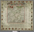
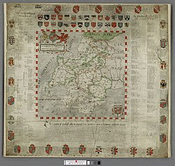
George Owen: Penbrochiae comitatus olim Demetiae regionis descriptio 1602   wikidata:Q106629024  reasonator:Q106629024
Artist
Owen, George, 1552-1613.
image of artwork listed in title parameter on this page
Author
George Owen  (1552–1613)  wikidata:Q5543081
 
Alternative names
George Owen of Henllys
Description naturalist, geologist and cartographer
Date of birth/death 1552  Edit this at Wikidata 26 August 1613  Edit this at Wikidata
Location of birth Nevern
Authority file
  Edit this at Wikidata
Title
Penbrochiae comitatus.
Object type individual copy of a map  Edit this at Wikidata
Genre county map  Edit this at Wikidata
Description
Shows Pembrokeshire, (partial information on adjacent counties). Identifies towns, larger villages, roads and rivers with diagramatic representation of hills, mountains and woodlands. Title, top left, below arms of Elizabeth I, scale, bottom left. Map periphery contains index to towns and villages and arms of families associated with Pembrokeshire.
Date 1602
date QS:P571,+1602-00-00T00:00:00Z/9
Dimensions 690 × 610 mm (27.16 × 24.01 in)
institution QS:P195,Q666063
Inscriptions
  • top left:
Penbrochiae comitatus olim Demetiae regionis descriptio 1602  Edit this at Wikidata
  • bottom:
The Countey of Penbrok called in auncient tyme Demetia ...
Notes Scale [ca.1:182,000]. 2.8 inches = 8 miles.
References http://hdl.handle.net/10107/1445608 ( English Edit this at Wikidata
Source/Photographer
  • The National Library of Wales
This image is available from the National Library of Wales
You can view this image in its original context on the NLW Catalogue
Permission
( Reusing this file)
Public domain

This work is in the public domain in its country of origin and other countries and areas where the copyright term is the author's life plus 100 years or fewer.


This work is in the public domain in the United States because it was published (or registered with the U.S. Copyright Office) before January 1, 1929.

Information

Captions

George Owens' Penbrochiae comitatus, a 1602 map of Pembrokeshire ion the National Library of Wales

File history

Click on a date/time to view the file as it appeared at that time.

Date/TimeThumbnailDimensionsUserComment
current 09:19, 26 February 2021 Thumbnail for version as of 09:19, 26 February 20218,456 × 7,992 (25.22 MB)Jason.nlwhigh res
16:12, 11 March 2016 Thumbnail for version as of 16:12, 11 March 20165,028 × 4,736 (8.06 MB)Jason.nlwBetter quality
16:09, 11 March 2016 Thumbnail for version as of 16:09, 11 March 2016757 × 711 (182 KB)Jason.nlwReverted to version as of 13:01, 21 October 2015 (UTC)
16:09, 11 March 2016 Thumbnail for version as of 16:09, 11 March 20163,361 × 2,937 (5.98 MB)Jason.nlwhigh res. original colour
13:01, 21 October 2015 Thumbnail for version as of 13:01, 21 October 2015757 × 711 (182 KB)Jason.nlwUser created page with UploadWizard
The following pages on the English Wikipedia use this file (pages on other projects are not listed):

Global file usage

The following other wikis use this file: