No higher resolution available.
General_Jose_Castro_House,_Mission_Plaza,_San_Juan_Bautista_(San_Benito_County,_California).jpg (584 × 410 pixels, file size: 114 KB, MIME type: image/jpeg)
| This is a file from the
Wikimedia Commons. Information from its
description page there is shown below. Commons is a freely licensed media file repository. You can help. |
.jpg)
| Description |
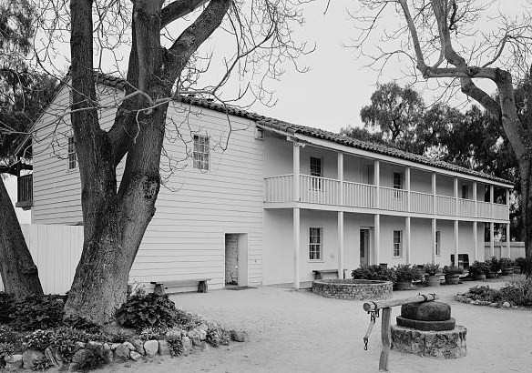
General Jose Castro House, Mission Plaza, San Juan Bautista (San Benito County, California) - (cropped).
|
||||
| Date | 1930s | ||||
| Source | http://memory.loc.gov/cgi-bin/displayPhoto.pl?path=/pnp/habshaer/ca/ca0500/ca0556/photos&topImages=201134pr.jpg&topLinks=201134pv.jpg,201134pu.tif&title=ca&displayProfile=0 | ||||
| Author | Unknown author | ||||
| Permission ( Reusing this file) |
Historic American Buildings Survey ca |
| Object location |
| View this and other nearby images on: OpenStreetMap |
|
|---|
.jpg¶ms=036.844722_N_-121.534722_E_globe:Earth_class:object_region:US_type:landmark_scale:1500_&language=en)

|
This file comes from the
Historic American Buildings Survey (HABS), Historic American Engineering Record (HAER) or Historic American Landscapes Survey (HALS). These are programs of the National Park Service established for the purpose of documenting historic places. Records consist of measured drawings, archival photographs, and written reports.
This tag does not indicate the copyright status of the attached work. A normal copyright tag is still required. See Commons:Licensing. |
| This image or media file contains material based on a work of a National Park Service employee, created as part of that person's official duties. As a work of the U.S. federal government, such work is in the public domain in the United States. See the NPS website and NPS copyright policy for more information. |
File history
Click on a date/time to view the file as it appeared at that time.
| Date/Time | Thumbnail | Dimensions | User | Comment | |
|---|---|---|---|---|---|
| current | 11:25, 13 May 2008 |
| 584 × 410 (114 KB) | KudzuVine | {{Information |Description=General Jose Castro House, Mission Plaza, San Juan Bautista (San Benito County, California) (cropped) |Source=http://memory.loc.gov/cgi-bin/displayPhoto.pl?path=/pnp/habshaer/ca/ca0500/ca0556/photos&topImages=201134pr.jpg&topLin |
File usage
The following pages on the English Wikipedia use this file (pages on other projects are not listed):
Global file usage
The following other wikis use this file:
- Usage on de.wikipedia.org
- Usage on fr.wikipedia.org
- Usage on nl.wikipedia.org
.jpg)