Size of this preview:
720 × 600 pixels. Other resolutions:
288 × 240 pixels |
576 × 480 pixels |
922 × 768 pixels |
1,200 × 1,000 pixels.
Original file (1,200 × 1,000 pixels, file size: 378 KB, MIME type: image/png)
| This is a file from the
Wikimedia Commons. Information from its
description page there is shown below. Commons is a freely licensed media file repository. You can help. |
Summary
| Description |
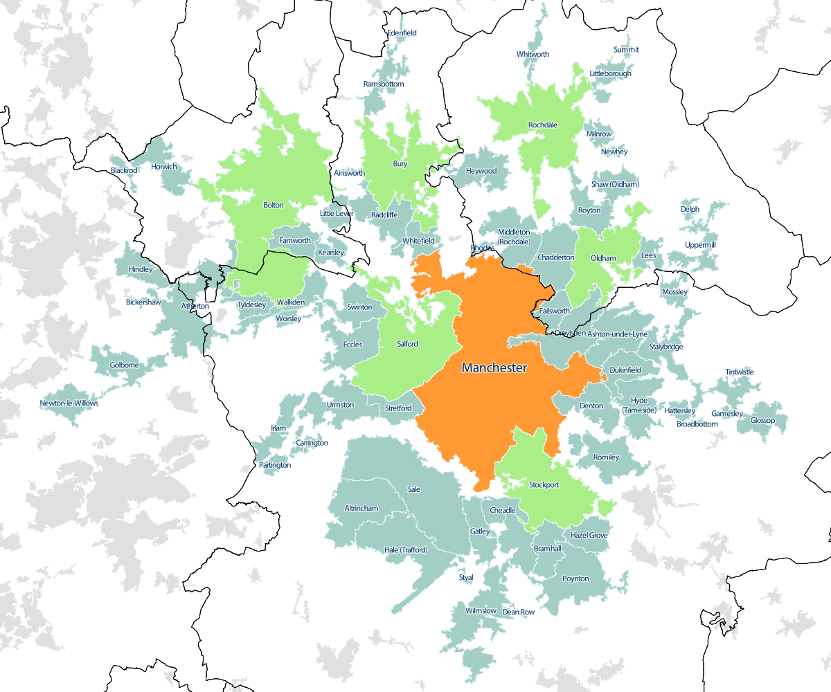
English: The
Greater Manchester Built-Up Area as at the 2011 Census, with overlay of the 2007 Travel to Work Areas. Manchester is highlighted in orange, and towns with local authority districts named after them highlighted in green. |
| Date | |
| Source |
Office of National Statistics Geography using the following GIS data:
|
| Author | Fingerpuppet, created using Office for National Statistics data |
Licensing
I, the copyright holder of this work, hereby publish it under the following license:
This file is licensed under the
Creative Commons
Attribution-Share Alike 3.0 Unported license.
- You are free:
- to share – to copy, distribute and transmit the work
- to remix – to adapt the work
- Under the following conditions:
- attribution – You must give appropriate credit, provide a link to the license, and indicate if changes were made. You may do so in any reasonable manner, but not in any way that suggests the licensor endorses you or your use.
- share alike – If you remix, transform, or build upon the material, you must distribute your contributions under the same or compatible license as the original.
File history
Click on a date/time to view the file as it appeared at that time.
| Date/Time | Thumbnail | Dimensions | User | Comment | |
|---|---|---|---|---|---|
| current | 19:20, 30 October 2013 |
| 1,200 × 1,000 (378 KB) | Fingerpuppet | User created page with UploadWizard |
File usage
The following pages on the English Wikipedia use this file (pages on other projects are not listed):
Global file usage
The following other wikis use this file:
- Usage on uk.wikipedia.org