
Size of this preview:
466 × 599 pixels. Other resolutions:
187 × 240 pixels |
373 × 480 pixels |
597 × 768 pixels |
796 × 1,024 pixels |
1,593 × 2,048 pixels |
5,600 × 7,200 pixels.
Original file (5,600 × 7,200 pixels, file size: 7.03 MB, MIME type: image/jpeg)
| This is a file from the
Wikimedia Commons. Information from its
description page there is shown below. Commons is a freely licensed media file repository. You can help. |
Summary
| Description |
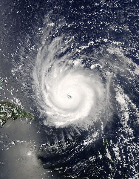
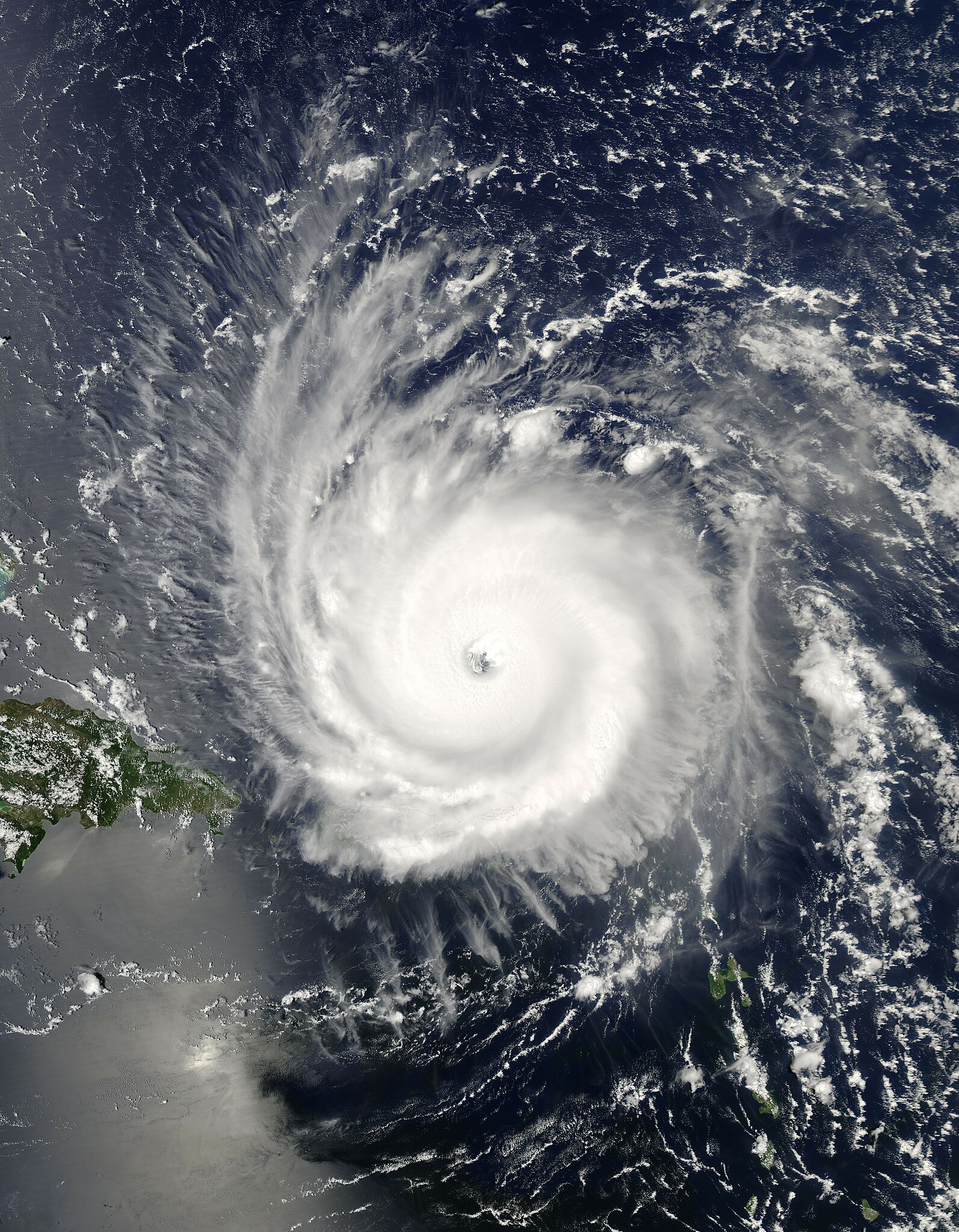
The MODIS instrument aboard NASA's Aqua satellite captured this true-color image of Hurricane Frances on August 31, 2004 at 17:55 UTC (1:55 PM EDT). At the time this image was taken Frances was located approximately 230 km (140 miles) north-northeast of San Juan, Puerto Rico and was moving towards the west near 26 km/hr (16 mph). Maximum sustained winds were near 225 km/hr (140 mph) and the storm's minimum central pressure was down to 942 millibars. The MODIS Rapid Response System provides this image at additional resolutions and formats. |
|||
| Date | ||||
| Source | http://visibleearth.nasa.gov/view_rec.php?id=6584 | |||
| Author | Jacques Descloitres, MODIS Rapid Response Team, NASA/GSFC | |||
| Permission ( Reusing this file) |
|
|||
| Other versions | Image:Hurricane Frances 2004.jpg |
File history
Click on a date/time to view the file as it appeared at that time.
| Date/Time | Thumbnail | Dimensions | User | Comment | |
|---|---|---|---|---|---|
| current | 21:50, 26 September 2006 |
| 5,600 × 7,200 (7.03 MB) | Good kitty | |
| 04:27, 3 May 2006 |
 | 2,800 × 3,600 (2.43 MB) | Titoxd | {{information | Description=Image of Hurricane Frances near Hispaniola | Source= http://earthobservatory.nasa.gov/NaturalHazards/natural_hazards_v2.php3?img_id=12389 | Date=uploaded May 3, 2006 | Author=NASA | Permissi |
File usage
The following pages on the English Wikipedia use this file (pages on other projects are not listed):
Global file usage
The following other wikis use this file:
- Usage on ca.wikipedia.org
- Usage on eo.wikipedia.org
- Usage on es.wikipedia.org
- Usage on fi.wikipedia.org
- Usage on fr.wikipedia.org
- Usage on pl.wikipedia.org
- Usage on pt.wikipedia.org
- Usage on simple.wikipedia.org
- Usage on th.wikipedia.org
- Usage on uk.wikipedia.org
- Usage on www.wikidata.org
- Usage on zh.wikipedia.org