Size of this preview:
800 × 561 pixels. Other resolutions:
320 × 224 pixels |
640 × 448 pixels |
1,024 × 717 pixels |
1,280 × 897 pixels |
1,500 × 1,051 pixels.
Original file (1,500 × 1,051 pixels, file size: 570 KB, MIME type: image/jpeg)
| This is a file from the
Wikimedia Commons. Information from its
description page there is shown below. Commons is a freely licensed media file repository. You can help. |
| Description |
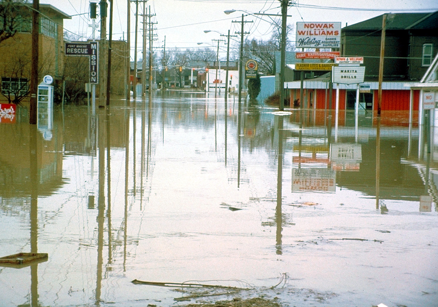
English: Flooded streets in Fort Wayne, Indiana, USA, during the disastrous floods of 1982. |
|||
| Date | ||||
| Source |
U.S. Army Corps of Engineers Digital Visual Library Image page Image description page Digital Visual Library home page |
|||
| Author | U.S. Army Corps of Engineers, photographer not specified or unknown | |||
| Permission ( Reusing this file) |
|
|||
| Location | Fort Wayne, Indiana, USA |
| Camera location | | View this and other nearby images on: OpenStreetMap |
|
|---|
File history
Click on a date/time to view the file as it appeared at that time.
| Date/Time | Thumbnail | Dimensions | User | Comment | |
|---|---|---|---|---|---|
| current | 04:14, 29 March 2007 |
| 1,500 × 1,051 (570 KB) | DanMS | {{Information | Description = {{en|Flooded streets in Fort Wayine, Indiana, USA, during the disastrous floods of 1982.}} | Source = U.S. Army Corps of Engineers Digital Visual Library<br />[http://images.usace.army.mil/images/Hires/3998-55.Jpg |
File usage
The following pages on the English Wikipedia use this file (pages on other projects are not listed):
Global file usage
The following other wikis use this file:
- Usage on ast.wikipedia.org
- Usage on es.wikinews.org
- Usage on eu.wikipedia.org
- Usage on gl.wikipedia.org
- Usage on hy.wikipedia.org
- Usage on io.wikipedia.org
- Usage on ja.wikipedia.org
- Usage on pl.wikipedia.org