Size of this preview:
800 × 532 pixels. Other resolutions:
320 × 213 pixels |
640 × 426 pixels |
1,024 × 681 pixels |
1,280 × 851 pixels |
2,560 × 1,702 pixels |
6,016 × 4,000 pixels.
Original file (6,016 × 4,000 pixels, file size: 6.23 MB, MIME type: image/jpeg)
| This is a file from the
Wikimedia Commons. Information from its
description page there is shown below. Commons is a freely licensed media file repository. You can help. |
|
This is an image of a place or building that is listed on the
National Register of Historic Places in the
United States of America. Its reference number is
89001921. |
| Camera location |
| View this and other nearby images on: OpenStreetMap |
|
|---|
| Description |
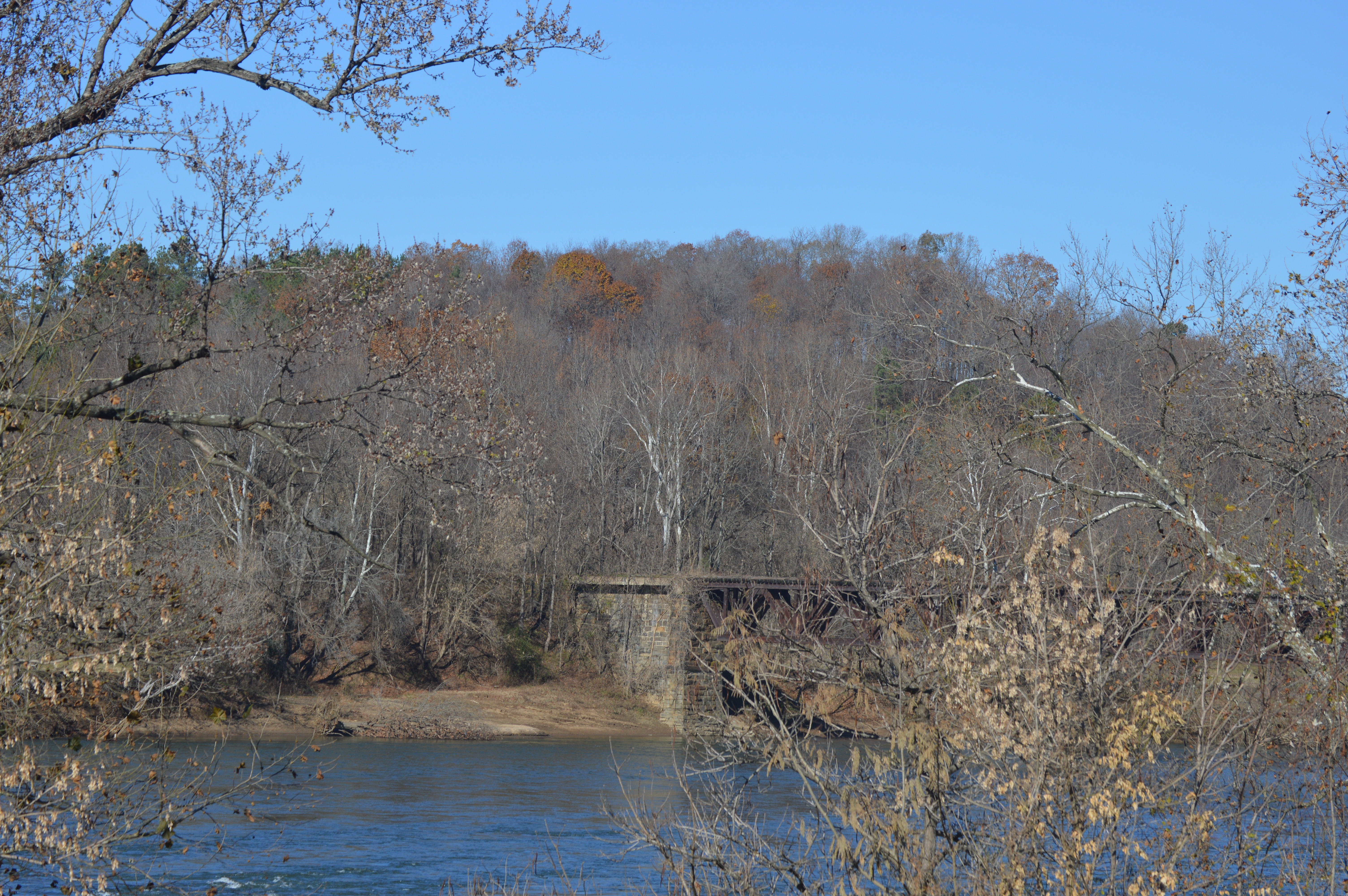
English: Distant view from the southeast of the site of
Fort Riverview, which sits on a hilltop above the
James River in
Amherst County,
Virginia,
United States. The photo is taken from the Mount Athos Road bridge over Little Beaver Creek in
Campbell County. Note the
Six Mile Bridge below the hilltop. The fort is listed on the
National Register of Historic Places. |
||
| Date | Taken on 21 November 2018 | ||
| Source | Own work | ||
| Author | Nyttend | ||
| Permission ( Reusing this file) |
|
||
| Other versions | None |
File history
Click on a date/time to view the file as it appeared at that time.
| Date/Time | Thumbnail | Dimensions | User | Comment | |
|---|---|---|---|---|---|
| current | 01:03, 10 March 2019 |
| 6,016 × 4,000 (6.23 MB) | Nyttend |
File usage
The following pages on the English Wikipedia use this file (pages on other projects are not listed):
Global file usage
The following other wikis use this file:
- Usage on www.wikidata.org