
Size of this preview:
800 × 241 pixels. Other resolutions:
320 × 97 pixels |
640 × 193 pixels |
1,024 × 309 pixels |
1,280 × 386 pixels |
2,560 × 772 pixels |
12,679 × 3,824 pixels.
Original file (12,679 × 3,824 pixels, file size: 8.48 MB, MIME type: image/jpeg)
| This is a file from the
Wikimedia Commons. Information from its
description page there is shown below. Commons is a freely licensed media file repository. You can help. |
Summary
| Description |
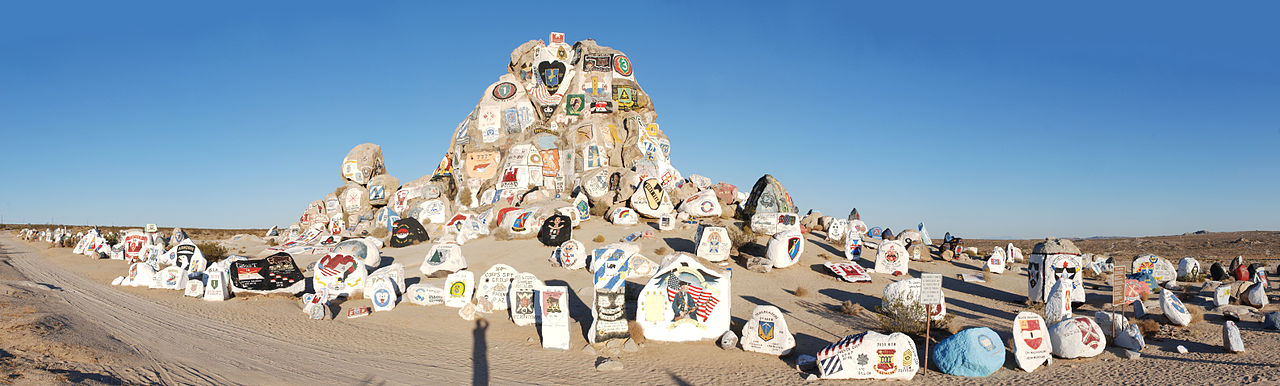
English: Painted Rock at the entrance to
Fort Irwin National Training Center in
California, covered with the insignia of units that have trained here. |
| Date | |
| Source | Own work |
| Author | Jarek Tuszyński |
| Camera location | | View this and other nearby images on: OpenStreetMap |
|
|---|
Licensing
Jarek Tuszyński, the copyright holder of this work, hereby publishes it under the following license:
This file is licensed under the
Creative Commons
Attribution-Share Alike 3.0 Unported license.
Attribution:
Jarek Tuszyński / CC-BY-SA-3.0
- You are free:
- to share – to copy, distribute and transmit the work
- to remix – to adapt the work
- Under the following conditions:
- attribution – You must give appropriate credit, provide a link to the license, and indicate if changes were made. You may do so in any reasonable manner, but not in any way that suggests the licensor endorses you or your use.
- share alike – If you remix, transform, or build upon the material, you must distribute your contributions under the same or compatible license as the original.
| Annotations | This image is annotated: View the annotations at Commons |

This image has been assessed using the
Quality image guidelines and is considered a
Quality image.
|
File history
Click on a date/time to view the file as it appeared at that time.
| Date/Time | Thumbnail | Dimensions | User | Comment | |
|---|---|---|---|---|---|
| current | 14:43, 13 September 2012 |
| 12,679 × 3,824 (8.48 MB) | Jarekt | remove dust spots |
| 06:24, 8 November 2011 |
| 12,720 × 3,824 (5.75 MB) | Jarekt |
File usage
The following pages on the English Wikipedia use this file (pages on other projects are not listed):
Global file usage
The following other wikis use this file:
- Usage on ja.wikipedia.org