
Size of this preview:
800 × 531 pixels. Other resolutions:
320 × 212 pixels |
640 × 425 pixels |
1,024 × 680 pixels |
1,280 × 850 pixels |
2,059 × 1,367 pixels.
Original file (2,059 × 1,367 pixels, file size: 277 KB, MIME type: image/jpeg)
| This is a file from the
Wikimedia Commons. Information from its
description page there is shown below. Commons is a freely licensed media file repository. You can help. |
|
This is an image of a place or building that is listed on the
National Register of Historic Places in the
United States of America. Its reference number is
75001493. |
Summary
| Description |
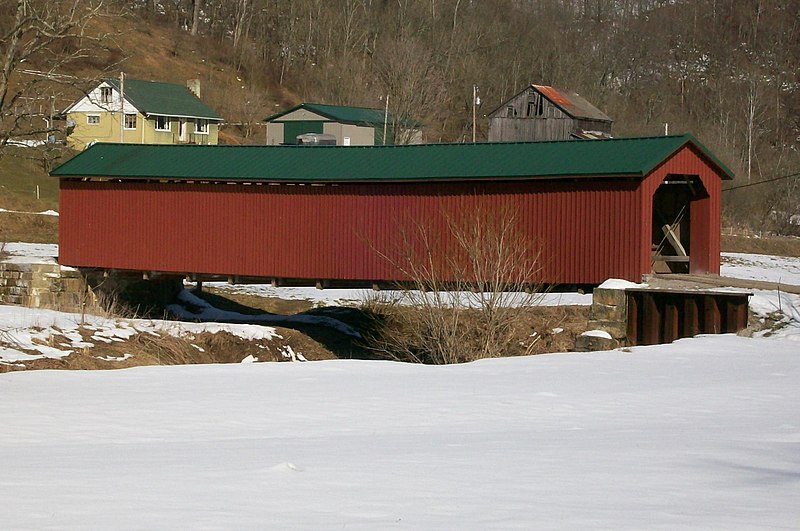
English: The Foreaker Covered Bridge is the last active covered bridge in Monroe County, Ohio. The bridge carries traffic from Plainview Road over the Little Muskingum River. Camera is facing east from Stonehouse Road. Taken March 4, 2010. |
| Date | (UTC) |
| Source |
I (
Bwsmith84 (
talk)) created this work entirely by myself. Transferred from en.wikipedia |
| Author | Bwsmith84 ( talk) |
| Permission ( Reusing this file) |
Bwsmith84 at
en.wikipedia, the copyright holder of this work, hereby publishes it under the following license: This file is licensed under the
Creative Commons
Attribution 3.0 Unported license. Attribution:
Bwsmith84 at
en.wikipedia
|
| Object location |
| View this and other nearby images on: OpenStreetMap |
|
|---|
Original upload log
The original description page was
here. All following user names refer to en.wikipedia.
- 2010-03-05 03:03 Bwsmith84 2059×1367 (283143 bytes) {{Information |Description = The Foreaker Covered Bridge is the last active covered bridge in Monroe County, Ohio. The bridge carries traffic from Plainview Road over the Little Muskingum River. Camera is facing east from Stonehouse Road. Taken March
File history
Click on a date/time to view the file as it appeared at that time.
| Date/Time | Thumbnail | Dimensions | User | Comment | |
|---|---|---|---|---|---|
| current | 03:10, 9 January 2012 |
| 2,059 × 1,367 (277 KB) | BotMultichillT | {{BotMoveToCommons|en.wikipedia|year={{subst:CURRENTYEAR}}|month={{subst:CURRENTMONTHNAME}}|day={{subst:CURRENTDAY}}}} == {{int:filedesc}} == {{Information |description={{en|1=The Foreaker Covered Bridge is the last active covered bridge in Monroe County |
File usage
The following pages on the English Wikipedia use this file (pages on other projects are not listed):
Global file usage
The following other wikis use this file:
- Usage on es.wikipedia.org
- Usage on eu.wikipedia.org
- Usage on fa.wikipedia.org
- Usage on pt.wikipedia.org
- Usage on ur.wikipedia.org
- Usage on vi.wikipedia.org
- Usage on www.wikidata.org
- Usage on zh.wikipedia.org