Original file (6,000 × 4,000 pixels, file size: 20.03 MB, MIME type: image/jpeg)
| This is a file from the
Wikimedia Commons. Information from its
description page there is shown below. Commons is a freely licensed media file repository. You can help. |
.jpg)
Summary
| Description |
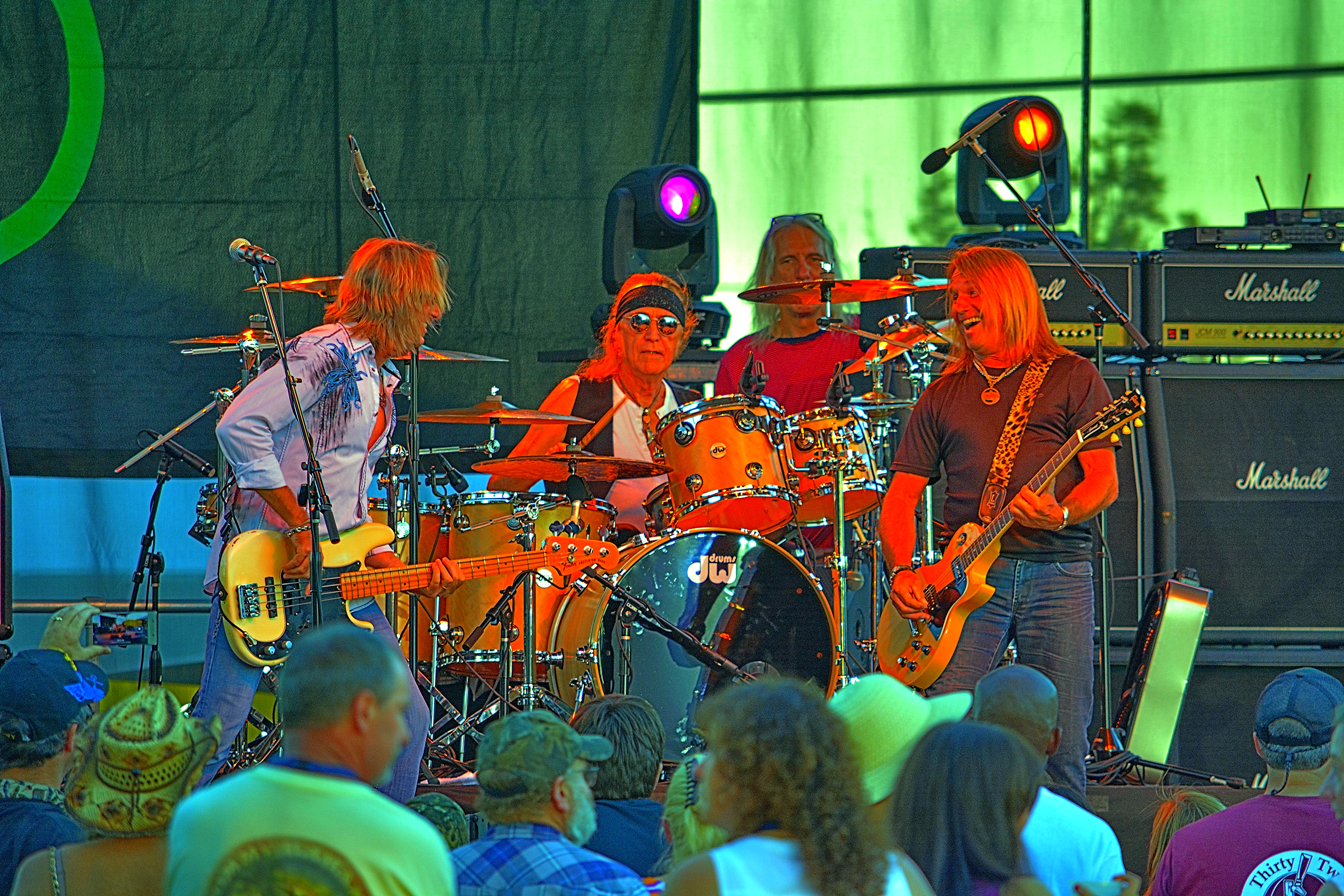
This year at the Benton County Oregon Fair was Foghat who began their career in 1971 as a bunch of rather unpretentious young Brits with an affection for American blues and '50s rock 'n' roll. By the middle of the decade, they had evolved into a major touring and recording act, playing a pumped-up brand of boogie-rock to arena-size audiences. Their looks grew flashier, their sound fattened and filled out, yet the roots-rock core of the band remained ever-present under the surface. From the viewpoint of certain critics, Foghat unduly compromised their early blues-based approach in order to reap commercial rewards. Certainly, their mid-'70s hits ("Slow Ride," "Drivin' Wheel," "Stone Blue") were not aimed at the rock purists of the world. But it's also true that they continued to record traditional blues and R&B material throughout their years with Bearsville Records. In fact, Foghat's final albums on Bearsville reaffirmed their love for unadulterated, primal American music.
|
| Date | |
| Source | Foghat on Stage |
| Author | Kirt Edblom from Kihei, Hi, United States |
| Camera location |
| View this and other nearby images on: OpenStreetMap |
|
|---|
.jpg¶ms=044.567587_N_-123.312628_E_globe:Earth_type:camera_source:Flickr_&language=en)
Licensing
- You are free:
- to share – to copy, distribute and transmit the work
- to remix – to adapt the work
- Under the following conditions:
- attribution – You must give appropriate credit, provide a link to the license, and indicate if changes were made. You may do so in any reasonable manner, but not in any way that suggests the licensor endorses you or your use.
- share alike – If you remix, transform, or build upon the material, you must distribute your contributions under the same or compatible license as the original.
| This image was originally posted to Flickr by Kirt Edblom at https://flickr.com/photos/27190564@N02/20710187958. It was reviewed on 15 June 2020 by FlickreviewR 2 and was confirmed to be licensed under the terms of the cc-by-sa-2.0. |
File history
Click on a date/time to view the file as it appeared at that time.
| Date/Time | Thumbnail | Dimensions | User | Comment | |
|---|---|---|---|---|---|
| current | 06:46, 15 June 2020 |
| 6,000 × 4,000 (20.03 MB) | TaurusEmerald | Transferred from Flickr via #flickr2commons |
File usage
Global file usage
The following other wikis use this file:
.jpg)