
Size of this preview:
800 × 157 pixels. Other resolutions:
320 × 63 pixels |
640 × 126 pixels |
1,024 × 201 pixels |
1,280 × 251 pixels |
2,560 × 503 pixels |
10,544 × 2,071 pixels.
Original file (10,544 × 2,071 pixels, file size: 6.48 MB, MIME type: image/jpeg)
| This is a file from the
Wikimedia Commons. Information from its
description page there is shown below. Commons is a freely licensed media file repository. You can help. |
Summary
| Description |
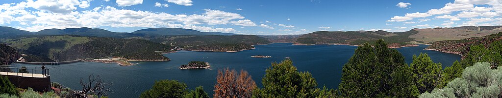
English: A panoramic of six images of the Flaming Gorge Reservoir. The photos were taken from the upper viewing platform off Highway 191.
|
||
| Date | |||
| Source | Own work | ||
| Author | JonathanLamb |

| Camera location | | View this and other nearby images on: OpenStreetMap |
|
|---|
Licensing
I, the copyright holder of this work, hereby publish it under the following license:
This file is licensed under the
Creative Commons
Attribution 3.0 Unported license.
- You are free:
- to share – to copy, distribute and transmit the work
- to remix – to adapt the work
- Under the following conditions:
- attribution – You must give appropriate credit, provide a link to the license, and indicate if changes were made. You may do so in any reasonable manner, but not in any way that suggests the licensor endorses you or your use.
File history
Click on a date/time to view the file as it appeared at that time.
| Date/Time | Thumbnail | Dimensions | User | Comment | |
|---|---|---|---|---|---|
| current | 01:13, 21 July 2010 |
| 10,544 × 2,071 (6.48 MB) | JonathanLamb~commonswiki | {{Information |Description={{en|1=A panoramic of six images of the Flaming Gorge Reservoir. The photos were taken from the upper viewing platform off Highway 191.}} |Source={{own}} |Author= JonathanLamb |Date=2010-07-12 |Permission= | |
File usage
The following pages on the English Wikipedia use this file (pages on other projects are not listed):
Global file usage
The following other wikis use this file:
- Usage on es.wikipedia.org
- Usage on fr.wikipedia.org