Size of this preview:
800 × 533 pixels. Other resolutions:
320 × 213 pixels |
640 × 427 pixels |
1,024 × 683 pixels |
1,280 × 853 pixels |
2,560 × 1,707 pixels |
5,184 × 3,456 pixels.
Original file (5,184 × 3,456 pixels, file size: 7.29 MB, MIME type: image/jpeg)
| This is a file from the
Wikimedia Commons. Information from its
description page there is shown below. Commons is a freely licensed media file repository. You can help. |
Summary
| Description |
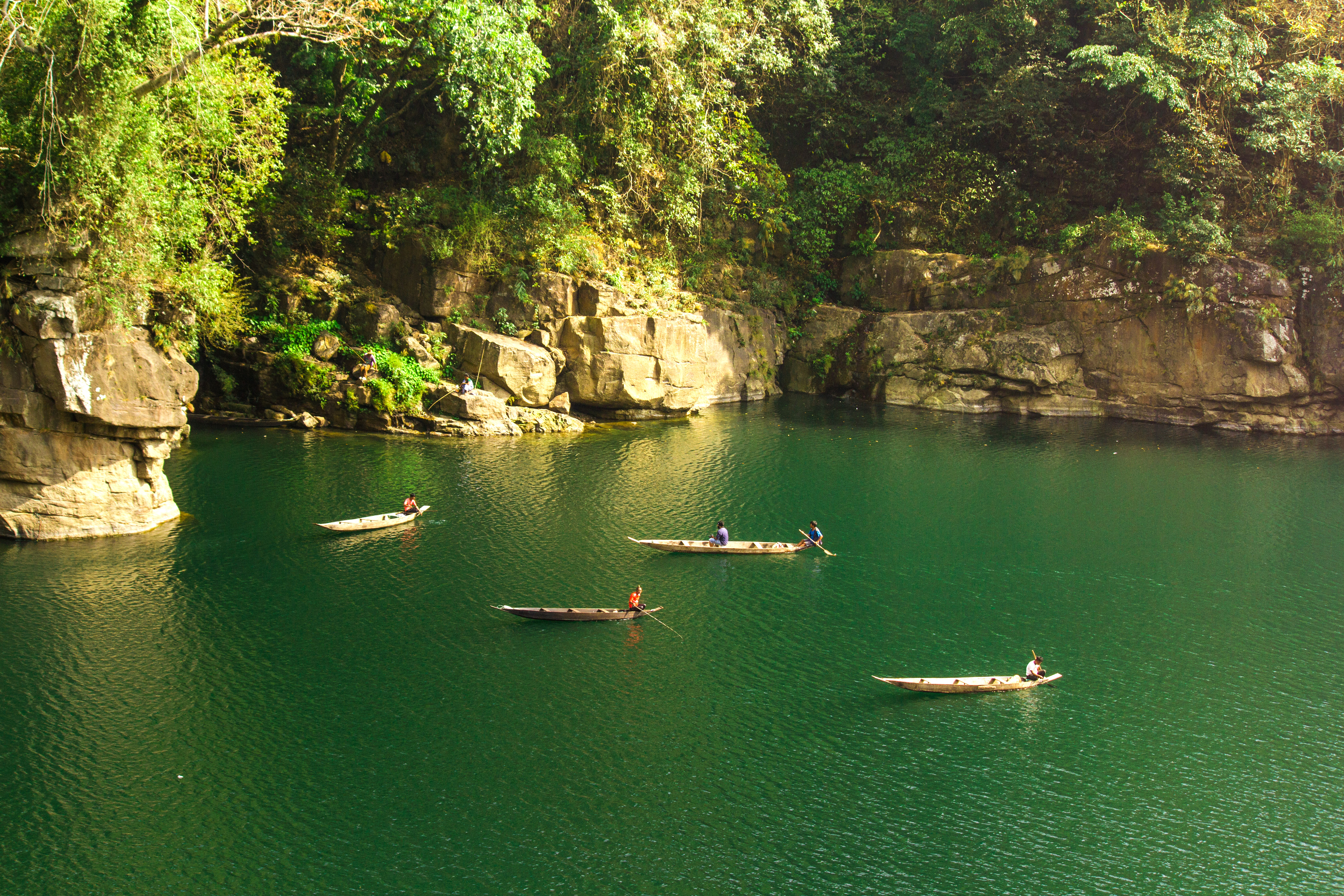
English: Along the border of India-Bangladesh, near the Tamabil-Dawki checkpost flows the beautiful Dawki river with greenish-blueish water so clear that one can see the bottom of the river even from as high as the bridge over the river. It flows very close to the customs checkpost at Dawki with Jaintia Hills District on one side and East Khasi Hills District on the other. As it enters the plains of Bangladesh it loses its beautiful color and becomes heavily strewn with rocks and small boulders. Local fishermen give boat rides to people visiting the area and sing songs while rowing he boat.
Located at the end of the Guwahati-Shillong-Dawki Road, Dawki is a small town well known for its sweet, juicy orange markets. I took the photograph from a hill, near the beautiful suspension bridge (built by the British colonial rulers before India's independence). |
| Date | |
| Source | Own work |
| Author | AditiVerma2193 |
| Camera location |
| View this and other nearby images on: OpenStreetMap |
|
|---|
Licensing
I, the copyright holder of this work, hereby publish it under the following license:
This file is licensed under the
Creative Commons
Attribution-Share Alike 4.0 International license.
- You are free:
- to share – to copy, distribute and transmit the work
- to remix – to adapt the work
- Under the following conditions:
- attribution – You must give appropriate credit, provide a link to the license, and indicate if changes were made. You may do so in any reasonable manner, but not in any way that suggests the licensor endorses you or your use.
- share alike – If you remix, transform, or build upon the material, you must distribute your contributions under the same or compatible license as the original.
|
|
This image was uploaded as part of
Wiki Loves Earth 2016.
|
 |
File history
Click on a date/time to view the file as it appeared at that time.
| Date/Time | Thumbnail | Dimensions | User | Comment | |
|---|---|---|---|---|---|
| current | 09:56, 3 June 2016 |
| 5,184 × 3,456 (7.29 MB) | AditiVerma2193 | User created page with UploadWizard |
File usage
The following pages on the English Wikipedia use this file (pages on other projects are not listed):
Global file usage
The following other wikis use this file:
- Usage on bcl.wikipedia.org
- Usage on bn.wikipedia.org
- Usage on id.wikipedia.org