
Size of this PNG preview of this SVG file:
670 × 299 pixels. Other resolutions:
320 × 143 pixels |
640 × 286 pixels |
1,024 × 457 pixels |
1,280 × 571 pixels |
2,560 × 1,142 pixels.
Original file (SVG file, nominally 670 × 299 pixels, file size: 215 KB)
| This is a file from the
Wikimedia Commons. Information from its
description page there is shown below. Commons is a freely licensed media file repository. You can help. |
Summary
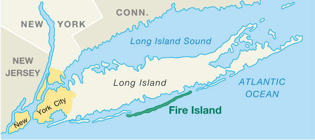
| Description | Fire Island, New York, US, Location Map |
| Date | created/published 2006-03-07 |
| Source | National Park Service, Area Map, converted from PDF file, modified |
| Author | U.S. Department of Interior, National Park Service |
| Other versions |
|

Licensing
| This image or media file contains material based on a work of a National Park Service employee, created as part of that person's official duties. As a work of the U.S. federal government, such work is in the public domain in the United States. See the NPS website and NPS copyright policy for more information. |
File history
Click on a date/time to view the file as it appeared at that time.
| Date/Time | Thumbnail | Dimensions | User | Comment | |
|---|---|---|---|---|---|
| current | 12:42, 27 October 2017 |
| 670 × 299 (215 KB) | Opencooper | == {{int:filedesc}} == {{Information |Description = Fire Island, New York, US, Location Map |Source = [http://www.nps.gov/fiis/pphtml/maps.html National Park Service], [https://web.archive.org/web/20041027185131/http://data2.itc.nps.gov:80/parks/fiis/p... |
File usage
The following pages on the English Wikipedia use this file (pages on other projects are not listed):
Global file usage
The following other wikis use this file:
- Usage on ca.wikipedia.org
- Usage on de.wikipedia.org
- Usage on en.wiktionary.org
- Usage on es.wikipedia.org
- Usage on et.wikipedia.org
- Usage on fa.wikipedia.org
- Usage on fi.wikipedia.org
- Usage on fr.wikipedia.org
- Usage on it.wikipedia.org
- Usage on ko.wikipedia.org
- Usage on no.wikipedia.org
- Usage on pl.wikipedia.org
- Usage on pt.wikipedia.org
- Usage on simple.wikipedia.org
- Usage on sv.wikipedia.org
- Usage on tr.wikipedia.org
- Usage on zh.wikipedia.org