No higher resolution available.
Fiji_and_oceania.jpg (371 × 303 pixels, file size: 16 KB, MIME type: image/jpeg)
| This is a file from the
Wikimedia Commons. Information from its
description page there is shown below. Commons is a freely licensed media file repository. You can help. |

|
This locator map image could be re-created using
vector graphics as an
SVG file. This has several advantages; see
Commons:Media for cleanup for more information. If an SVG form of this image is available, please upload it and afterwards replace this template with
{{
vector version available|new image name}}
.
It is recommended to name the SVG file “Fiji and oceania.svg”—then the template Vector version available (or Vva) does not need the new image name parameter. |


| Description |
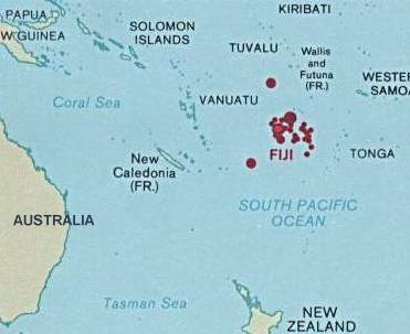
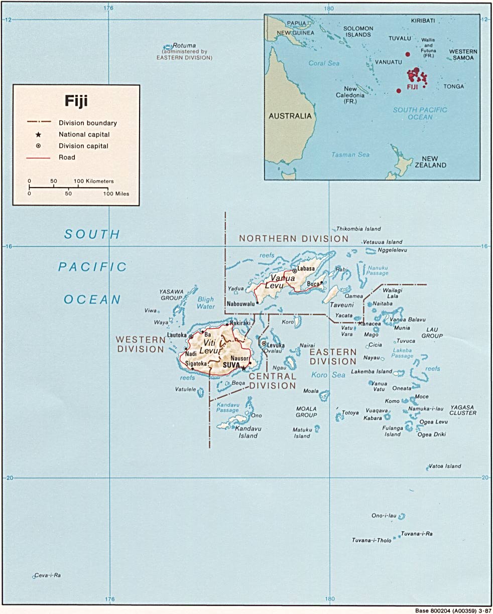
English: Map of Fiji showing the location in Oceania |
| Date | |
| Source | http://www.lib.utexas.edu/maps/islands_oceans_poles/fiji.jpg |
| Author | Central Intelligence Agency |
Licensing
| This image is a work of a
Central Intelligence Agency employee, taken or made as part of that person's official duties. As a Work of the United States Government, this image or media is in the
public domain in the United States.
|

|
Original upload log
The original description page was
here. All following user names refer to en.wikipedia.
- 2003-08-10 22:20 Pascal 371×303× (16043 bytes) Same map, a little bit smaller
- 2003-08-10 22:15 Pascal 422×308× (18365 bytes) Map of Fiji showing the location in Oceania from http://www.lib.utexas.edu/maps/index.html
File history
Click on a date/time to view the file as it appeared at that time.
| Date/Time | Thumbnail | Dimensions | User | Comment | |
|---|---|---|---|---|---|
| current | 19:45, 25 April 2009 |
| 371 × 303 (16 KB) | File Upload Bot (Magnus Manske) | {{BotMoveToCommons|en.wikipedia|year={{subst:CURRENTYEAR}}|month={{subst:CURRENTMONTHNAME}}|day={{subst:CURRENTDAY}}}} {{Information |Description={{en|Map of Fiji showing the location in Oceania<br/> en:Category:Maps of Fiji}} |Source=Transferred |
File usage
The following pages on the English Wikipedia use this file (pages on other projects are not listed):
Global file usage
The following other wikis use this file:
- Usage on ar.wikipedia.org
- Usage on hif.wikipedia.org
- Usage on it.wikipedia.org
- Usage on my.wikipedia.org
- Usage on pl.wikipedia.org
- Usage on sl.wikipedia.org
- Usage on ta.wikipedia.org
- Usage on ta.wikinews.org
- Usage on uk.wikipedia.org