Size of this preview:
800 × 493 pixels. Other resolutions:
320 × 197 pixels |
640 × 394 pixels |
1,024 × 631 pixels |
1,280 × 789 pixels |
1,817 × 1,120 pixels.
Original file (1,817 × 1,120 pixels, file size: 695 KB, MIME type: image/jpeg)
| This is a file from the
Wikimedia Commons. Information from its
description page there is shown below. Commons is a freely licensed media file repository. You can help. |
Summary
| Description |
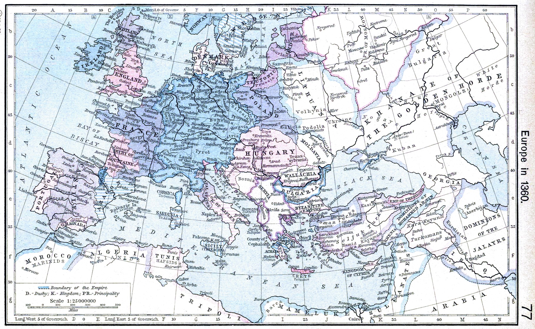
English: Europe in 1360. |
||||||||||||||||||||||
| Date | |||||||||||||||||||||||
| Source | http://www.lib.utexas.edu/maps/historical/shepherd/europe_1360.jpg | ||||||||||||||||||||||
| Author |
|
||||||||||||||||||||||
| Other versions | Derivative works of this file: | ||||||||||||||||||||||
.jpg)
_en.png)
.png)
.jpg)
Licensing
|
The author died in 1934, so this work is in the public domain in its country of origin and other countries and areas where the copyright term is the author's life plus 80 years or fewer. This work is in the public domain in the United States because it was published (or registered with the U.S. Copyright Office) before January 1, 1929. | |
| This file has been identified as being free of known restrictions under copyright law, including all related and neighboring rights. | |
File history
Click on a date/time to view the file as it appeared at that time.
| Date/Time | Thumbnail | Dimensions | User | Comment | |
|---|---|---|---|---|---|
| current | 20:51, 24 April 2009 |
| 1,817 × 1,120 (695 KB) | Alex:D | contrast |
| 10:31, 8 May 2006 |
 | 1,817 × 1,120 (424 KB) | Roke~commonswiki | Europe in 1360 {{Europe}} {{PD-PCL|http://www.lib.utexas.edu/maps/historical/shepherd/europe_1360.jpg}} Category: Historical maps of Europe |
File usage
The following pages on the English Wikipedia use this file (pages on other projects are not listed):
Global file usage
The following other wikis use this file:
- Usage on ar.wikipedia.org
- Usage on azb.wikipedia.org
- Usage on bg.wikipedia.org
- Usage on ca.wikipedia.org
- Usage on da.wikipedia.org
- Usage on es.wikipedia.org
- Usage on fa.wikipedia.org
- Usage on fr.wikipedia.org
- Usage on hr.wikipedia.org
- Usage on hy.wikipedia.org
- Usage on id.wikipedia.org
- Usage on it.wikipedia.org
- Usage on nl.wikipedia.org
- Usage on nrm.wikipedia.org
- Usage on pl.wikipedia.org
- Usage on scn.wikipedia.org
- Usage on sh.wikipedia.org
- Usage on sr.wikipedia.org
- Usage on vi.wikipedia.org