
Size of this preview:
800 × 598 pixels. Other resolutions:
320 × 239 pixels |
640 × 478 pixels |
1,024 × 765 pixels.
Original file (1,024 × 765 pixels, file size: 479 KB, MIME type: image/jpeg)
| This is a file from the
Wikimedia Commons. Information from its
description page there is shown below. Commons is a freely licensed media file repository. You can help. |
| Description |
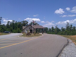
English: Entrance area to Bogue Chitto State Park near Franklinton, Louisiana. |
| Date | |
| Source | Own work |
| Author | Michael miceli |
| Permission ( Reusing this file) |
This file is licensed under the
Creative Commons
Attribution-Share Alike 2.0 Generic license. Attribution: Michael and Christopher Miceli
|
| Camera location |
| View this and other nearby images on: OpenStreetMap |
|
|---|
File history
Click on a date/time to view the file as it appeared at that time.
| Date/Time | Thumbnail | Dimensions | User | Comment | |
|---|---|---|---|---|---|
| current | 15:21, 12 May 2011 |
| 1,024 × 765 (479 KB) | Vermiceli | {{Information |Description ={{en|1=Entrance area to Bogue Chitto State Park near Franklinton, Louisiana.}} |Source ={{own}} |Author = Michael miceli |Date =2011-05-11 |Permission ={{Cc-by-sa-2.0|1=Mi |
File usage
The following pages on the English Wikipedia use this file (pages on other projects are not listed):
Global file usage
The following other wikis use this file:
- Usage on ms.wikipedia.org
- Usage on www.wikidata.org