No higher resolution available.
EllisIsland_(map_of_buildings).png (300 × 300 pixels, file size: 46 KB, MIME type: image/png)
| This is a file from the
Wikimedia Commons. Information from its
description page there is shown below. Commons is a freely licensed media file repository. You can help. |
.png)
Summary
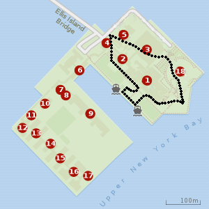
| Description | New York City enclave in Ellis Island | ||
| Source | Template:Own based on a previous wrong picture about the NY/NJ state border in Ellis Island | ||
| Author | Forza NYCFC !! | ||
| Permission ( Reusing this file) |
|
File history
Click on a date/time to view the file as it appeared at that time.
| Date/Time | Thumbnail | Dimensions | User | Comment | |
|---|---|---|---|---|---|
| current | 16:02, 25 April 2020 |
| 300 × 300 (46 KB) | Forza NYCFC !! | {{Information |description= |date= |source={{own}} |author= User:Forza NYCFC !! |permission= |other versions= }} |
File usage
The following pages on the English Wikipedia use this file (pages on other projects are not listed):
Global file usage
The following other wikis use this file:
- Usage on ar.wikipedia.org
- Usage on www.wikidata.org
.png)