Size of this preview:
775 × 599 pixels. Other resolutions:
310 × 240 pixels |
621 × 480 pixels |
936 × 724 pixels.
Original file (936 × 724 pixels, file size: 110 KB, MIME type: image/jpeg)
| This is a file from the
Wikimedia Commons. Information from its
description page there is shown below. Commons is a freely licensed media file repository. You can help. |
Summary
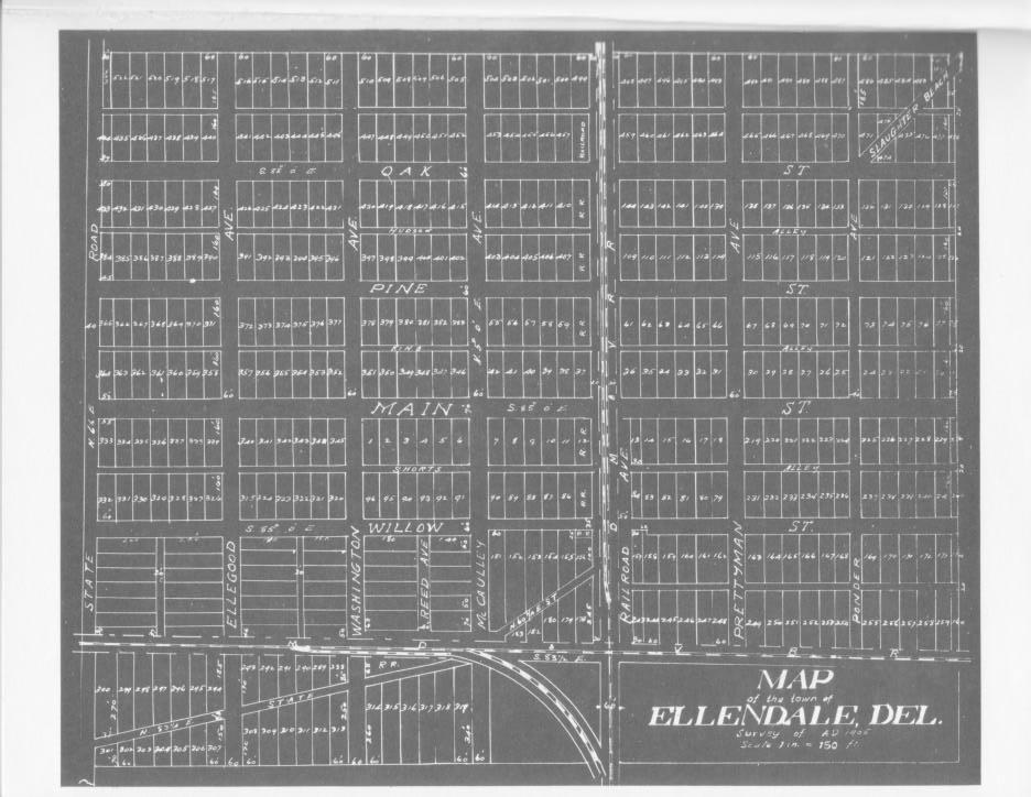
| Description | Map of the town of Ellendale, Delaware as planners laid it out in 1906. |
| Date | |
| Source | http://stateplanning.delaware.gov/comp_plans/ellendale_illustrations_maps.pdf |
| Author | |
| Permission ( Reusing this file) |
Map is from 1906, as indicated on map |
Licensing
This media file is in the
public domain in the
United States. This applies to U.S. works where the copyright has expired, often because its first
publication occurred prior to January 1, 1929, and if not then due to lack of notice or renewal. See
this page for further explanation.
|
 | |
 |
This image might not be in the public domain outside of the United States; this especially applies in the countries and areas that do not apply the
rule of the shorter term for US works, such as Canada, Mainland China (not Hong Kong or Macao), Germany, Mexico, and Switzerland. The creator and year of publication are essential information and must be provided. See
Wikipedia:Public domain and
Wikipedia:Copyrights for more details.
|
File history
Click on a date/time to view the file as it appeared at that time.
| Date/Time | Thumbnail | Dimensions | User | Comment | |
|---|---|---|---|---|---|
| current | 22:36, 14 March 2008 |
| 936 × 724 (110 KB) | Electrikpimp | {{Information |Description= Map of the town of Ellendale, Delaware as planners laid it out in 1906. |Source= http://stateplanning.delaware.gov/comp_plans/ellendale_illustrations_maps.pdf |Date= |Author= |Permission= Map is from 1906, as indicated on map |
File usage
The following pages on the English Wikipedia use this file (pages on other projects are not listed):