
Size of this preview:
796 × 599 pixels. Other resolutions:
319 × 240 pixels |
638 × 480 pixels |
1,020 × 768 pixels |
1,280 × 964 pixels |
2,560 × 1,927 pixels |
2,816 × 2,120 pixels.
Original file (2,816 × 2,120 pixels, file size: 1.43 MB, MIME type: image/jpeg)
| This is a file from the
Wikimedia Commons. Information from its
description page there is shown below. Commons is a freely licensed media file repository. You can help. |
Summary
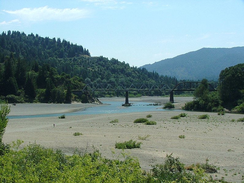
| Description | Dyerville is located to the right of this photo along a sliver of land behind state park land along the North Fork of the Eel River. The South Fork merges from the right. Dyerville is bordered on the west side by Humboldt Redwoods State Park, notably Founders Grove. Avenue of the Giants, the old Highway 101, cuts through this portion of the park. The four-lane Highway 101 is also to the right of this photo. Some residents remain in the area generally regarded as Dyerville, which once was a bustling place along the railroad, evidence by the railroad trestle shown in the photo. The railroad is shut down between Willits and Samoa. |
| Date | |
| Source | Own work |
| Author | Jan Kronsell |
| Camera location |
| View this and other nearby images on: OpenStreetMap |
|
|---|
Licensing
| I, the copyright holder of this work, release this work into the
public domain. This applies worldwide. In some countries this may not be legally possible; if so: I grant anyone the right to use this work for any purpose, without any conditions, unless such conditions are required by law. |
File history
Click on a date/time to view the file as it appeared at that time.
| Date/Time | Thumbnail | Dimensions | User | Comment | |
|---|---|---|---|---|---|
| current | 23:14, 27 November 2007 |
| 2,816 × 2,120 (1.43 MB) | Jan Kronsell | {{Information |Description=Former location of Dyerville, along Eel River near Avenue of the Giants, Humboldt Redwood State Park, California |Source=self-made |Date=july 2006 |Author= Jan Kronsell |Permission= |other_versions= }} [[C |
File usage
The following pages on the English Wikipedia use this file (pages on other projects are not listed):
Global file usage
The following other wikis use this file:
- Usage on arz.wikipedia.org
- Usage on bg.wikipedia.org
- Usage on ceb.wikipedia.org
- Usage on da.wikipedia.org
- Usage on de.wikipedia.org
- Usage on fr.wikipedia.org
- Usage on gl.wikipedia.org
- Usage on it.wikipedia.org
- Usage on ml.wikipedia.org
- Usage on tr.wikipedia.org
- Usage on www.wikidata.org
- Usage on xmf.wikipedia.org