Size of this preview:
800 × 532 pixels. Other resolutions:
320 × 213 pixels |
640 × 426 pixels |
1,024 × 681 pixels |
1,280 × 851 pixels |
2,560 × 1,702 pixels |
6,016 × 4,000 pixels.
Original file (6,016 × 4,000 pixels, file size: 5.93 MB, MIME type: image/jpeg)
| This is a file from the
Wikimedia Commons. Information from its
description page there is shown below. Commons is a freely licensed media file repository. You can help. |
| Camera location |
| View this and other nearby images on: OpenStreetMap |
|
|---|
| Description |
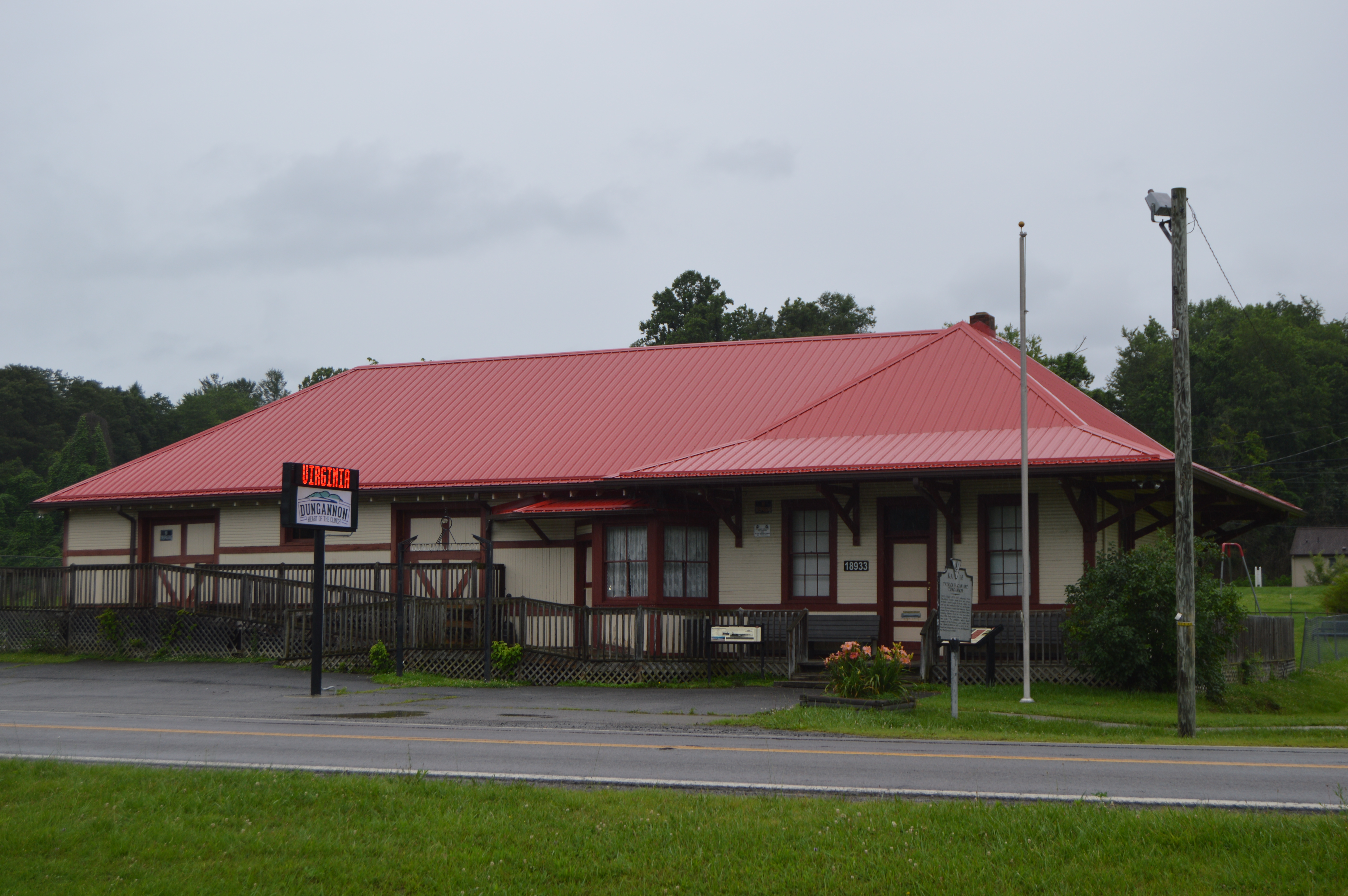
English: Front of the Dungannon
Clinchfield depot (now a community center), located on Third Avenue (State Routes
65/
72) across from the post office in
Dungannon,
Virginia,
United States. |
||
| Date | Taken on 22 June 2017 | ||
| Source | Own work | ||
| Author | Nyttend | ||
| Permission ( Reusing this file) |
|
||
| Other versions | None |
File history
Click on a date/time to view the file as it appeared at that time.
| Date/Time | Thumbnail | Dimensions | User | Comment | |
|---|---|---|---|---|---|
| current | 01:50, 5 July 2017 |
| 6,016 × 4,000 (5.93 MB) | Nyttend | {{Location|36|49|39.5|N|82|28|8|W}} {{Information |Description={{en|Front of the Dungannon {{w|Clinchfield Railroad|Clinchfield}} depot (now a community center), located on Third Avenue (State Routes {{w|Virginia State Route 65|65}}/{{w|Virginia State... |
File usage
The following pages on the English Wikipedia use this file (pages on other projects are not listed):