
Size of this preview:
400 × 600 pixels. Other resolutions:
160 × 240 pixels |
320 × 480 pixels |
512 × 768 pixels |
683 × 1,024 pixels |
1,365 × 2,048 pixels |
3,311 × 4,966 pixels.
Original file (3,311 × 4,966 pixels, file size: 13.81 MB, MIME type: image/jpeg)
| This is a file from the
Wikimedia Commons. Information from its
description page there is shown below. Commons is a freely licensed media file repository. You can help. |
.jpg)
| Description |
English:
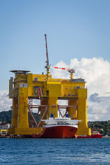
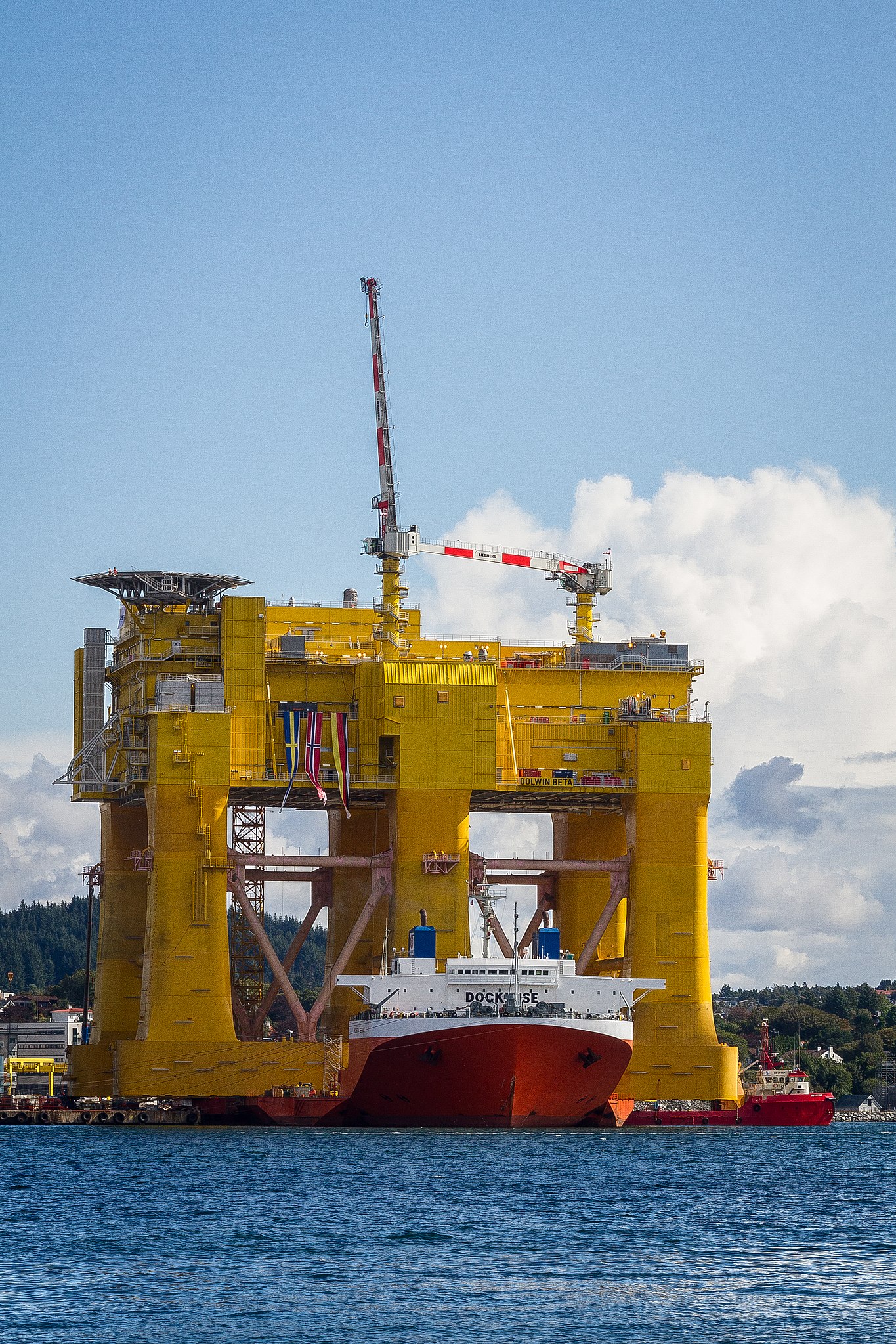
Mighty Servant 1 heavy-lift ship transporting DolWin beta offshore HVDC converter platform at Haugesund, Norway.
Not that it is such a great shot in its own right, but I just had to take a picture of this! It is right outside my doorstep. Viewed from my house on the Karmøy island towards east and the city of Haugesund. No - I am not playing with perspective or anything here. That ship (Mighty Servant 1) IS actually carrying this huge structure. The project is a cooperation between Aibel Norway and ABB. The structure itself has been built in Dubai, and is now at the Aibel yard in Haugesund for final equipment installations and testing. It has a capacity of 900 MW and will receive power from 240 wind turbines in the North Sea from Q2 2015. |
| Date | |
| Source | Dolwin Beta |
| Author | Sten Dueland from Haugesund and Stavanger, Norway |
| Camera location |
| View this and other nearby images on: OpenStreetMap |
|
|---|
.jpg¶ms=059.406254_N_0005.268898_E_globe:Earth_type:camera_source:Flickr_&language=en)
Licensing
This file is licensed under the
Creative Commons
Attribution-Share Alike 2.0 Generic license.
Attribution: Sten Dueland
- You are free:
- to share – to copy, distribute and transmit the work
- to remix – to adapt the work
- Under the following conditions:
- attribution – You must give appropriate credit, provide a link to the license, and indicate if changes were made. You may do so in any reasonable manner, but not in any way that suggests the licensor endorses you or your use.
- share alike – If you remix, transform, or build upon the material, you must distribute your contributions under the same or compatible license as the original.
| This image was originally posted to Flickr by Sten Dueland at https://www.flickr.com/photos/89879880@N05/14823021740. It was reviewed on 27 August 2014 by FlickreviewR and was confirmed to be licensed under the terms of the cc-by-sa-2.0. |
 |
When this file was uploaded to Wikimedia Commons, it was available from Flickr under the stated license. The Flickr user has since stopped distributing the file under this license. As Creative Commons licenses cannot be revoked in this manner, the file is still free to use under the terms of the license specified. See the Creative Commons FAQ on
revoking licensing.
|
File history
Click on a date/time to view the file as it appeared at that time.
| Date/Time | Thumbnail | Dimensions | User | Comment | |
|---|---|---|---|---|---|
| current | 19:23, 27 August 2014 |
| 3,311 × 4,966 (13.81 MB) | 4ing | Transferred from Flickr via Flickr2commons |
File usage
The following pages on the English Wikipedia use this file (pages on other projects are not listed):
Global file usage
The following other wikis use this file:
- Usage on de.wikipedia.org
- Usage on nl.wikipedia.org
- Usage on uk.wikipedia.org
- Usage on www.wikidata.org
.jpg)