
Size of this preview:
450 × 600 pixels. Other resolutions:
180 × 240 pixels |
360 × 480 pixels |
576 × 768 pixels |
768 × 1,024 pixels |
1,673 × 2,230 pixels.
Original file (1,673 × 2,230 pixels, file size: 1.51 MB, MIME type: image/jpeg)
| This is a file from the
Wikimedia Commons. Information from its
description page there is shown below. Commons is a freely licensed media file repository. You can help. |
|
This is an image of a place or building that is listed on the
National Register of Historic Places in the
United States of America. Its reference number is
88001214. |
Summary
| Description |
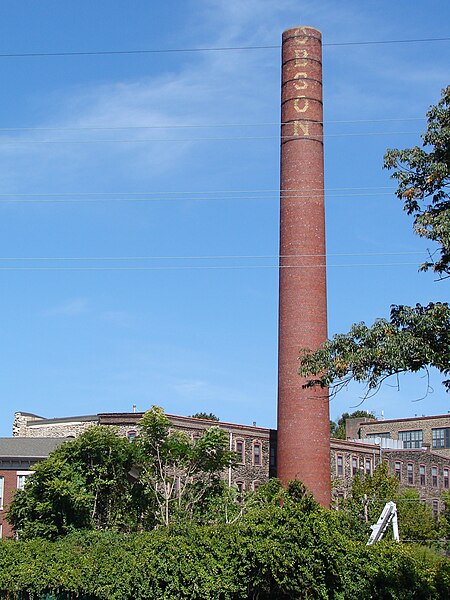
English: Dobson Mills in Philadelphia on the NRHP since July 28, 1988. At 4001–4041 Ridge Ave.and 3302–3530 Scott's Lane in the Hunting Park Industrial Area of North Philly. Note the smokestack now reads "OBSON" having obviously lost a "D" |
| Date | |
| Source | Own work |
| Author | Smallbones |
| Camera location |
| View this and other nearby images on: OpenStreetMap |
|
|---|
Licensing
| I, the copyright holder of this work, release this work into the
public domain. This applies worldwide. In some countries this may not be legally possible; if so: I grant anyone the right to use this work for any purpose, without any conditions, unless such conditions are required by law. |
File history
Click on a date/time to view the file as it appeared at that time.
| Date/Time | Thumbnail | Dimensions | User | Comment | |
|---|---|---|---|---|---|
| current | 14:12, 22 September 2010 |
| 1,673 × 2,230 (1.51 MB) | Smallbones | {{Information |Description={{en|1=Dobson Mills in Philadelphia on the NRHP since July 28, 1988. At 4001–4041 Ridge Ave.and 3302–3530 Scott's Lane in the Hunting Park Industrial Area of North Philly. Note the smokestack now reads "OBSON MILLS' havin |
File usage
The following pages on the English Wikipedia use this file (pages on other projects are not listed):
Global file usage
The following other wikis use this file:
- Usage on www.wikidata.org