Size of this preview:
800 × 511 pixels. Other resolutions:
320 × 205 pixels |
640 × 409 pixels |
1,134 × 725 pixels.
Original file (1,134 × 725 pixels, file size: 1.05 MB, MIME type: image/jpeg)
| This is a file from the
Wikimedia Commons. Information from its
description page there is shown below. Commons is a freely licensed media file repository. You can help. |
Summary
| Description |
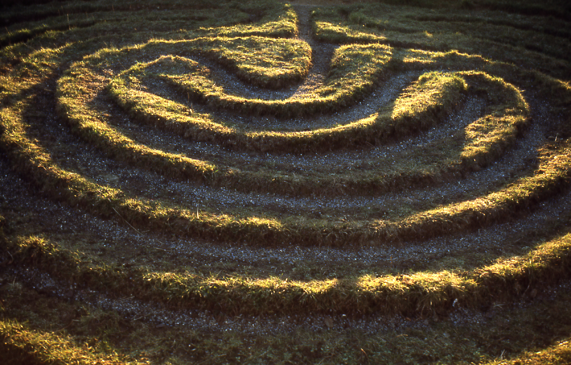
English: City of Troy. The only surviving example in the North Riding of this type of grass maze. It is located by a roadside in the Howardian Hills of Yorkshire, England, near the villages of Dalby, and Skewsby, close to Sheriff Hutton, a few miles north of York.
It is at grid reference SE6252871886 in Bonnygate Lane / High Lane. For some reason neither the Landranger map nor the Victorian Ordnance Survey map mark it. See the Megalithic Portal. Another image from Geograph. |
| Date | |
| Source | This is a scan of a transparency which I took in the 1970s, scanned and uploaded 8 May 2005. It has been slightly cleaned-up in Photoshop. |
| Author | User:SiGarb |
| Permission ( Reusing this file) |
Own work, all rights released. This version of the image is in the Public Domain. If it is used outside Wikipedia, a photographer's credit (Simon Garbutt) would be appreciated! |
| Other versions | (I retain the ownership and copyright of the original transparency and any higher-resolution scans derived from it.) SiGarb 18:46, 8 November 2005 (UTC) |
| Camera location |
| View this and other nearby images on: OpenStreetMap |
|
|---|
Licensing
| I, the copyright holder of this work, release this work into the
public domain. This applies worldwide. In some countries this may not be legally possible; if so: I grant anyone the right to use this work for any purpose, without any conditions, unless such conditions are required by law. |
File history
Click on a date/time to view the file as it appeared at that time.
| Date/Time | Thumbnail | Dimensions | User | Comment | |
|---|---|---|---|---|---|
| current | 18:46, 8 November 2005 |
| 1,134 × 725 (1.05 MB) | SiGarb | This is a scan of a transparency which I took in the 1970s. It has been slightly cleaned-up in Photoshop. It shows "The City of Troy", a roadside turf maze in the Howardian Hills of Yorkshire, England, near the villages of Dalby, and Skewsby, close to S |
File usage
The following pages on the English Wikipedia use this file (pages on other projects are not listed):
Global file usage
The following other wikis use this file:
- Usage on cs.wikipedia.org
- Usage on de.wikipedia.org
- Usage on es.wikipedia.org
- Usage on et.wikipedia.org
- Usage on fi.wikipedia.org
- Usage on gl.wikipedia.org
- Usage on ja.wikipedia.org
- Usage on nl.wikipedia.org
- Usage on ru.wikipedia.org
- Usage on th.wikipedia.org