Size of this preview:
505 × 600 pixels. Other resolutions:
202 × 240 pixels |
404 × 480 pixels.
Original file (800 × 950 pixels, file size: 101 KB, MIME type: image/jpeg)
| This is a file from the
Wikimedia Commons. Information from its
description page there is shown below. Commons is a freely licensed media file repository. You can help. |
| Description |
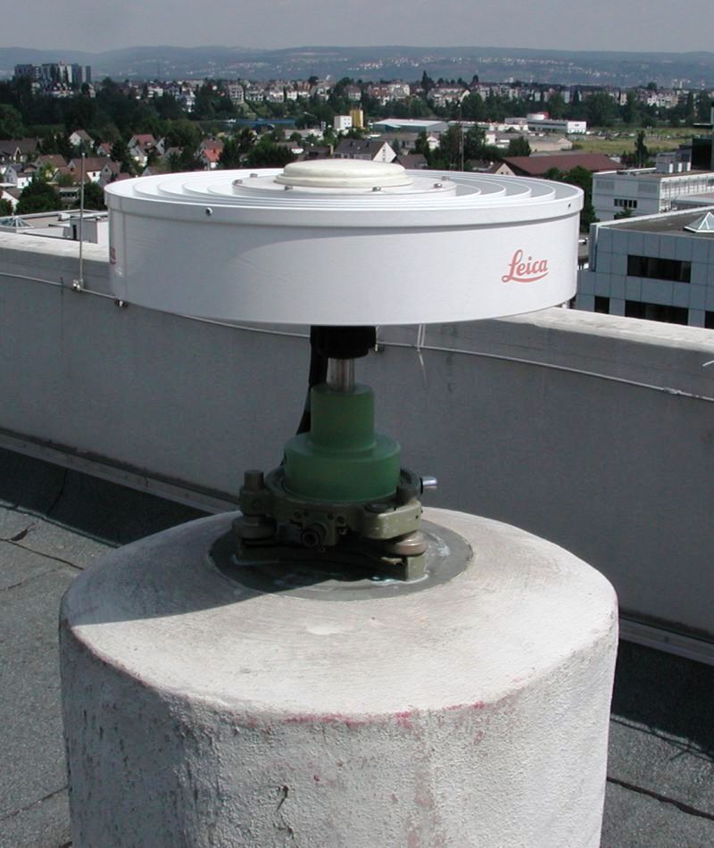
Deutsch: Eine DGPS-Referenzstation auf dem Dach des Landesamts für Vermessung und Geobasisinformation Rheinland-Pfalz (LVermGeo RP). Das LVermGeo RP ist für das Gebiet von Rheinland-Pfalz Betreiber des Satellitenpositionierungsdienstes der Deutschen Landesvermessung (SAPOS).
Español: Estación de referencia DGPS
English: DGPS Reference Station |
||||||||
| Date | |||||||||
| Source |
Own work (Stefan Kühn) English: Transferred from de.wikipedia.org
[1]: 2003-07-19 09:18 . . Stefan Kühn . . 800×950 (106121 bytes) |
||||||||
| Author | Stefan Kühn | ||||||||
| Permission ( Reusing this file) |
Stefan Kühn, the copyright holder of this work, hereby publishes it under the following license:
|

![[1]](https://de.wikipedia.org/?title=File%3ADGPS-Referenzstation.jpg)
| Camera location |
| View this and other nearby images on: OpenStreetMap |
|
|---|
File history
Click on a date/time to view the file as it appeared at that time.
| Date/Time | Thumbnail | Dimensions | User | Comment | |
|---|---|---|---|---|---|
| current | 08:58, 7 August 2007 |
| 800 × 950 (101 KB) | Tony Rotondas | {{Information |Description= {{de|**Bild einer DGPS-Referenzstation auf dem Dach des Landesamts für Vermessung und Geobasisinformation Rheinland-Pfalz (LVermGeo RP). Das LVermGeo RP ist für das Gebiet von Rheinland-Pfalz Betreiber des Satellitenpositioni |
File usage
The following pages on the English Wikipedia use this file (pages on other projects are not listed):
Global file usage
The following other wikis use this file:
- Usage on ar.wikipedia.org
- Usage on ca.wikipedia.org
- Usage on cs.wikipedia.org
- Usage on de.wikipedia.org
- Usage on es.wikipedia.org
- Usage on fi.wikipedia.org
- Usage on he.wikipedia.org
- Usage on it.wikipedia.org
- Usage on lv.wikipedia.org
- Usage on oc.wikipedia.org
- Usage on ru.wikipedia.org
- Usage on sk.wikipedia.org
- Usage on sr.wikipedia.org
- Usage on www.wikidata.org