
Size of this PNG preview of this SVG file:
600 × 600 pixels. Other resolutions:
240 × 240 pixels |
480 × 480 pixels |
768 × 768 pixels |
1,024 × 1,024 pixels |
2,048 × 2,048 pixels |
3,000 × 3,000 pixels.
Original file (SVG file, nominally 3,000 × 3,000 pixels, file size: 1.86 MB)
| This is a file from the
Wikimedia Commons. Information from its
description page there is shown below. Commons is a freely licensed media file repository. You can help. |
Summary
| Description |
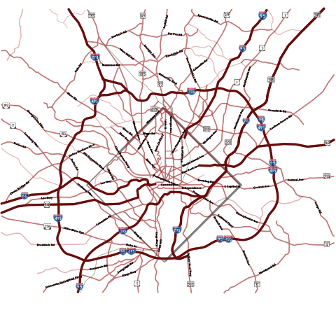
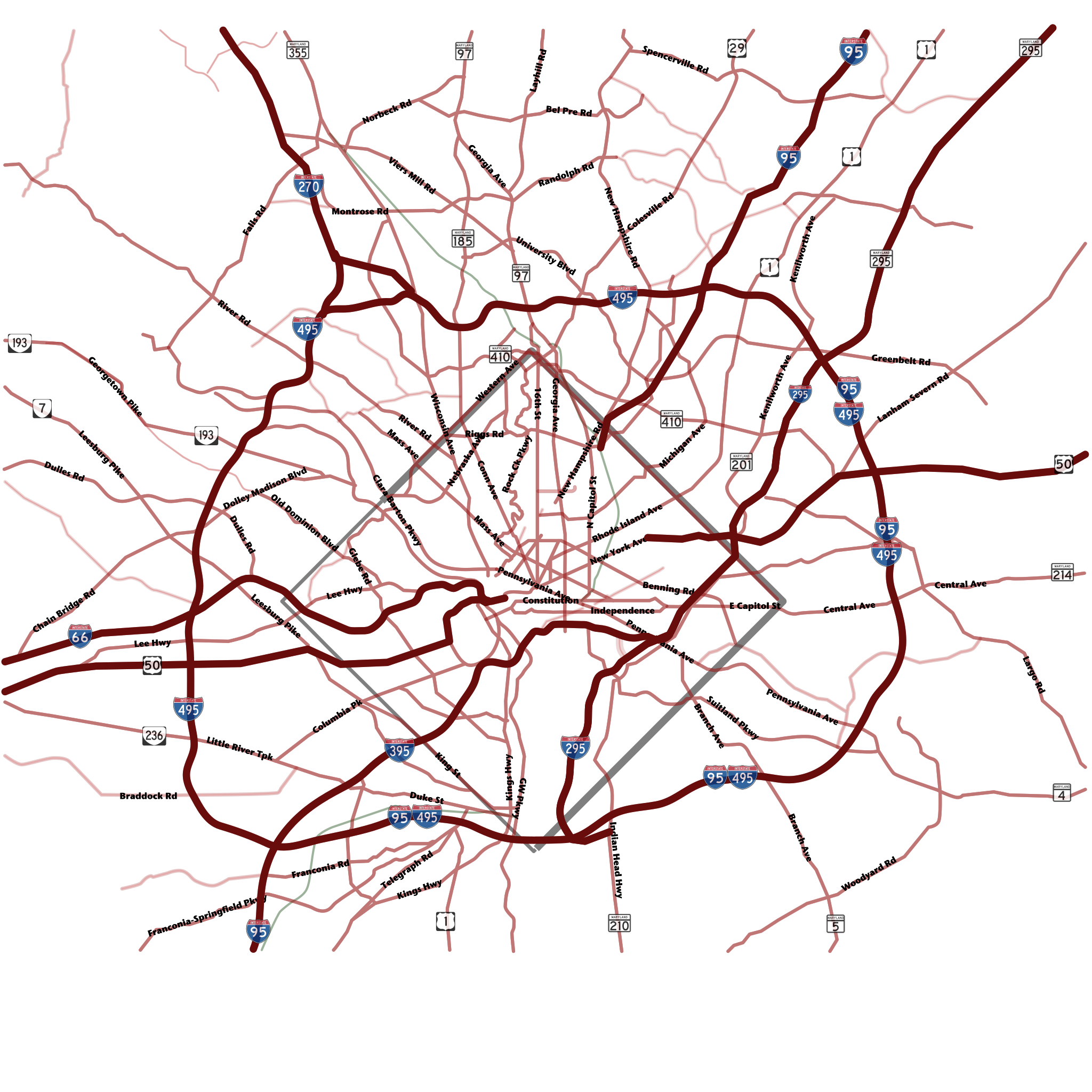
English: Washington, D.C. Metropolitan Area road map. This file should register with
Image:WashingtonDCAerialPhoto 2590x2000.jpg. |
| Date | |
| Source | Own work Made from an aerial photo mosaic by me. |
| Author | Mrflip |
| Other versions |
|


| Camera location |
| View this and other nearby images on: OpenStreetMap |
|
|---|
See Also

Licensing
| I, the copyright holder of this work, release this work into the
public domain. This applies worldwide. In some countries this may not be legally possible; if so: I grant anyone the right to use this work for any purpose, without any conditions, unless such conditions are required by law. |
File history
Click on a date/time to view the file as it appeared at that time.
| Date/Time | Thumbnail | Dimensions | User | Comment | |
|---|---|---|---|---|---|
| current | 23:02, 15 August 2007 |
| 3,000 × 3,000 (1.86 MB) | Mrflip | {{Information |Description=Washington, DC Area Road Map |Source=self-made |Date=2007-08-15 |Author= Mrflip }} {{Location dec|38.9371|-77.0306}} Category:Washington,_D.C. Category:395 Category:295 Category:Roads [[Category |
| 22:50, 15 August 2007 | No thumbnail | (1.39 MB) | Mrflip | {{Information |Description=Washington, DC Area Road Map |Source=self-made |Date=2007-08-15 |Author= Mrflip }} {{Location dec|38.9371|-77.0306}} Category:Washington,_D.C. Category:395 Category:295 Category:Roads [[Category |
File usage
The following pages on the English Wikipedia use this file (pages on other projects are not listed):
Global file usage
The following other wikis use this file:
- Usage on ca.wikipedia.org
- Usage on jv.wikipedia.org
- Usage on th.wikipedia.org
- Usage on vi.wikipedia.org
- Usage on www.wikidata.org