CrossHarborRailFacilityMap.png (415 × 349 pixels, file size: 15 KB, MIME type: image/png)
Summary
| Description |
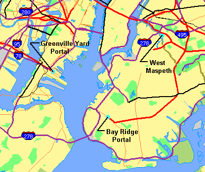
Map showing New York Harbor with adjacent parts of New York and New Jersey obtained from U.S. Census Bureau, with facilities of proposed Cross-Harbor Rail Tunnel shown on map by Cross Harbor Freight Movement Project superimposed and legends added by hand. | ||
|---|---|---|---|
| Source |
Mainly work of a U.S. government agency. The base map is from the US Census TIGER map browser, and is public domain. | ||
| Date | |||
| Author |
| ||
| Permission ( Reusing this file) |
See below.
|
Licensing
| This image is a work of a United States Census Bureau employee, taken or made as part of that person's official duties. As a work of the U.S. federal government, the image is in the public domain in the United States. |
 |
 | This file is a candidate to be copied to
Wikimedia Commons.
Any user may perform this transfer; refer to Wikipedia:Moving files to Commons for details. If this file has problems with attribution, copyright, or is otherwise ineligible for Commons, then remove this tag and DO NOT transfer it; repeat violators may be blocked from editing. Other Instructions
| ||
| |||
File history
Click on a date/time to view the file as it appeared at that time.
| Date/Time | Thumbnail | Dimensions | User | Comment | |
|---|---|---|---|---|---|
| current | 18:27, 21 May 2006 |
| 415 × 349 (15 KB) | Craig Bolon ( talk | contribs) | Map showing New York Harbor with adjacent parts of New York and New Jersey obtained from U.S. Census Bureau, with facilities of proposed Cross-Harbor Rail Tunnel shown on map by Cross Harbor Freight Movement Project superimposed and legends added by hand. |
| 16:31, 21 May 2006 |
 | 415 × 349 (15 KB) | Craig Bolon ( talk | contribs) | Map showing New York Harbor with adjacent parts of New York and New Jersey obtained from U.S. Census Bureau, with facilities of proposed Cross-Harbor Rail Tunnel shown on map by Cross Harbor Freight Movement Project superimposed and legends added by hand. |
You cannot overwrite this file.