Size of this preview:
800 × 600 pixels. Other resolutions:
320 × 240 pixels |
640 × 480 pixels |
1,024 × 768 pixels |
1,280 × 960 pixels |
2,560 × 1,920 pixels |
4,224 × 3,168 pixels.
Original file (4,224 × 3,168 pixels, file size: 1.88 MB, MIME type: image/jpeg)
| This is a file from the
Wikimedia Commons. Information from its
description page there is shown below. Commons is a freely licensed media file repository. You can help. |
Summary
| Description |
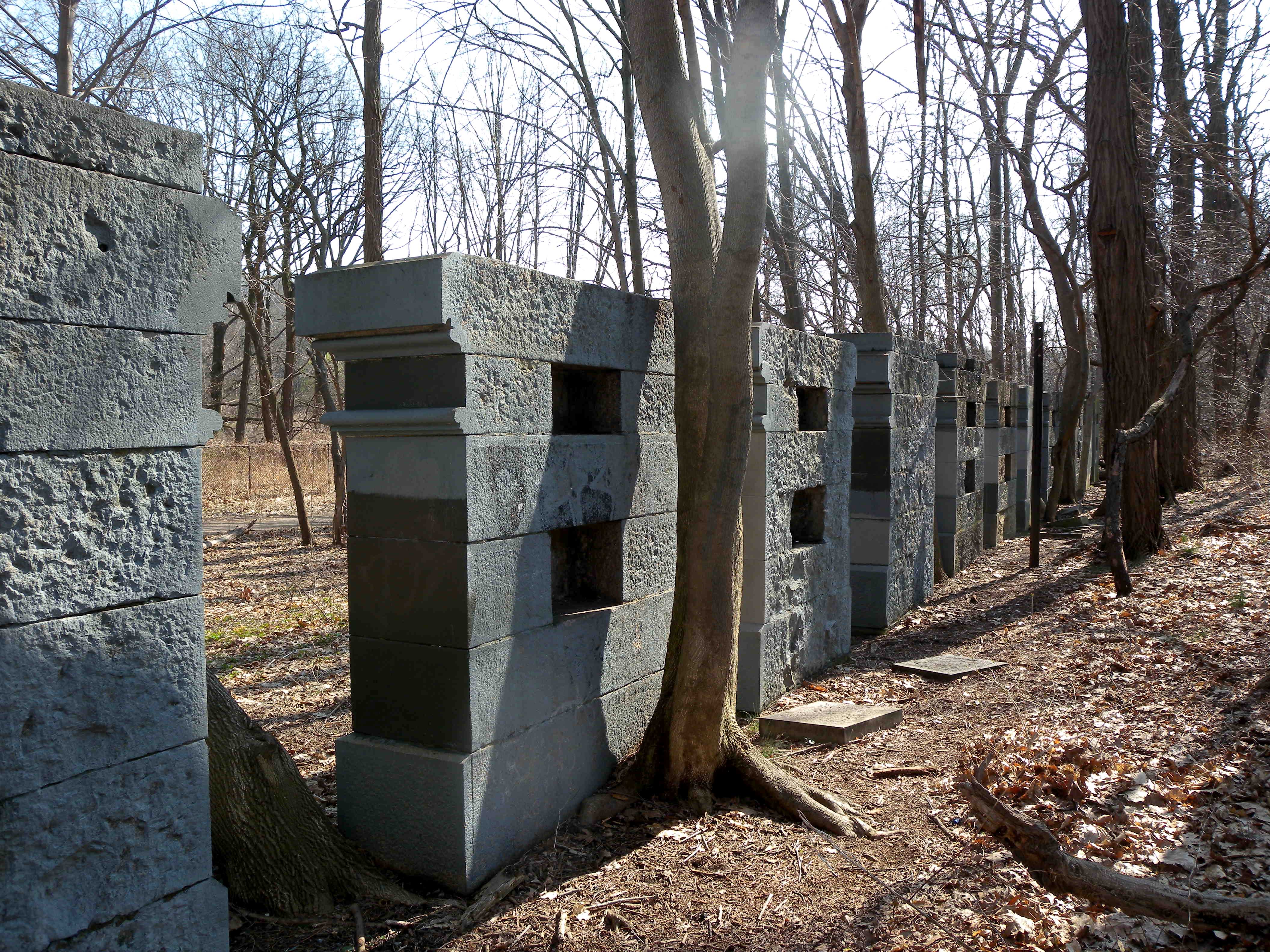
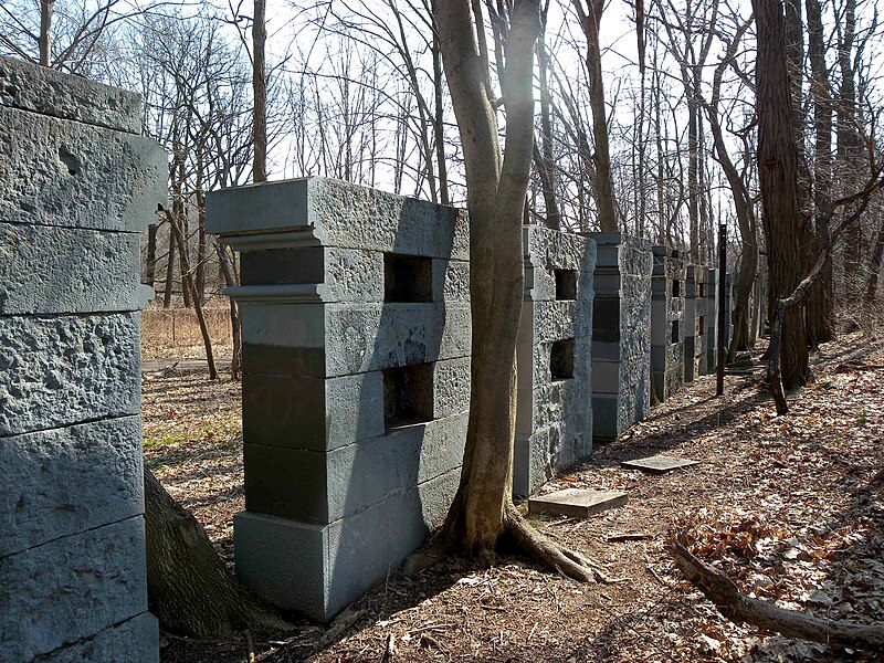
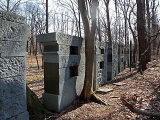
English: Looking south along a row of thirteen mysterious structures, between the Old Putnam Railroad and the great lawn of Van Cortlandt Park. They were built in the early 20th century to test different kinds of stone for Grand Central Terminal.
[1]. |
| Date | |
| Source | Own work |
| Author | Jim.henderson |
| Camera location | | View this and other nearby images on: OpenStreetMap |
|
|---|
References
- ↑ Forgotten New York Old Putnam Railroad
Licensing
| I, the copyright holder of this work, release this work into the
public domain. This applies worldwide. In some countries this may not be legally possible; if so: I grant anyone the right to use this work for any purpose, without any conditions, unless such conditions are required by law. |
File history
Click on a date/time to view the file as it appeared at that time.
| Date/Time | Thumbnail | Dimensions | User | Comment | |
|---|---|---|---|---|---|
| current | 03:36, 22 April 2009 |
| 4,224 × 3,168 (1.88 MB) | Jim.henderson | {{Information |Description={{en|1=Looking south along a row of mysterious structures, between the Old Putnam Railroad and the great lawn of Van Cortlandt Park. Category:Rail transport in New York City}} |Source=Own work by uploader |Author=[[User:Jim |
File usage
The following pages on the English Wikipedia use this file (pages on other projects are not listed):
Global file usage
The following other wikis use this file:
- Usage on www.wikidata.org