No higher resolution available.
Coker_Experimental_Farm_(Darlington_County,_South_Carolina).jpg (223 × 149 pixels, file size: 25 KB, MIME type: image/jpeg)
| This is a file from the
Wikimedia Commons. Information from its
description page there is shown below. Commons is a freely licensed media file repository. You can help. |
.jpg)
|
This is an image of a place or building that is listed on the
National Register of Historic Places in the
United States of America. Its reference number is
66000706. |
| Description |
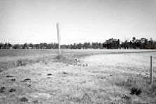
English: Coker Experimental Farms |
|||
| Date | Unknown date | |||
| Source | http://tps.cr.nps.gov/nhl/detail.cfm?ResourceId=529&ResourceType=Site | |||
| Author | Unknown author | |||
| Permission ( Reusing this file) |
|
| Object location |
| View this and other nearby images on: OpenStreetMap |
|
|---|
.jpg¶ms=034.363056_N_-080.059722_E_globe:Earth_class:object_region:US_type:landmark_scale:1500_&language=en)
File history
Click on a date/time to view the file as it appeared at that time.
| Date/Time | Thumbnail | Dimensions | User | Comment | |
|---|---|---|---|---|---|
| current | 22:56, 24 November 2009 |
| 223 × 149 (25 KB) | KudzuVine | {{Information |Description={{en|1= Coker Experimental Farms {{PD-USGov-NPS}}}} |Source=http://tps.cr.nps.gov/nhl/detail.cfm?ResourceId=529&ResourceType=Site |Author=NPS photo |Date=Unknown |Permission= |other_versions= }} [[Category:Darlington County, So |
File usage
The following pages on the English Wikipedia use this file (pages on other projects are not listed):
.jpg)