
Size of this preview:
763 × 600 pixels. Other resolutions:
305 × 240 pixels |
611 × 480 pixels |
977 × 768 pixels |
1,280 × 1,006 pixels |
2,560 × 2,013 pixels |
4,721 × 3,712 pixels.
Original file (4,721 × 3,712 pixels, file size: 2.12 MB, MIME type: image/jpeg)
| This is a file from the
Wikimedia Commons. Information from its
description page there is shown below. Commons is a freely licensed media file repository. You can help. |
|
This is an image of a place or building that is listed on the
National Register of Historic Places in the
United States of America. Its reference number is
90000339. |
| Camera location |
| View this and other nearby images on: OpenStreetMap |
|
|---|
| Description |
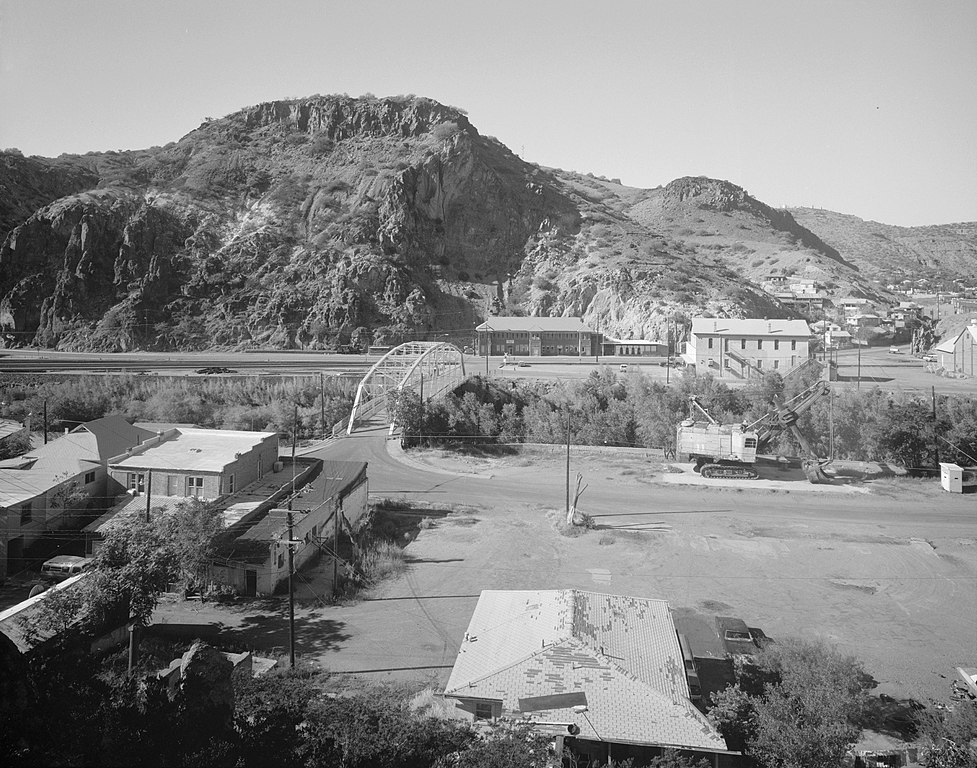
English: Buildings in the
Clifton Townsite Historic District of the town of
Clifton, located at the confluence of Chase Creek and the
San Francisco River in
Greenlee County,
Arizona,
United States. Visible in the middle of the picture is the
Park Avenue Bridge. Both the district and the bridge are listed on the
National Register of Historic Places. |
|||||
| Date | October or December 1993 | |||||
| Source | Library of Congress, Prints and Photograph Division HABS: ARIZ,6-CLIFT,36-3 | |||||
| Author | Robert G. Graham | |||||
| Permission ( Reusing this file) |
|


|
This image is available from the United States
Library of Congress's
Prints and Photographs division
under the digital ID hhh.az0313. This tag does not indicate the copyright status of the attached work. A normal copyright tag is still required. See Commons:Licensing.
|
File history
Click on a date/time to view the file as it appeared at that time.
| Date/Time | Thumbnail | Dimensions | User | Comment | |
|---|---|---|---|---|---|
| current | 15:41, 13 May 2009 |
| 4,721 × 3,712 (2.12 MB) | Mmxx | Retouched |
| 20:58, 12 May 2009 |
 | 4,665 × 3,655 (1.71 MB) | Cropbot | upload cropped version, operated by User:Finavon. Summary: border cropped | |
| 20:08, 12 May 2009 |
 | 5,000 × 4,004 (1.91 MB) | Nyttend | {{Location|33|3|20|N|109|17|53|W}} {{Information |Description={{en|Buildings in the {{w|Clifton Townsite Historic District}} of the town of {{w|Clifton, Arizona|Clifton}}, located at the confluence of Chase Creek and the {{w|San Francisco River}} in {{w|G |
File usage
The following pages on the English Wikipedia use this file (pages on other projects are not listed):
Global file usage
The following other wikis use this file:
- Usage on ar.wikipedia.org
- Usage on fa.wikipedia.org
- Usage on uk.wikipedia.org
- Usage on www.wikidata.org