Size of this preview:
800 × 275 pixels. Other resolutions:
320 × 110 pixels |
640 × 220 pixels |
1,024 × 351 pixels |
2,462 × 845 pixels.
Original file (2,462 × 845 pixels, file size: 7.95 MB, MIME type: image/png)
| This is a file from the
Wikimedia Commons. Information from its
description page there is shown below. Commons is a freely licensed media file repository. You can help. |
Summary
| Description |
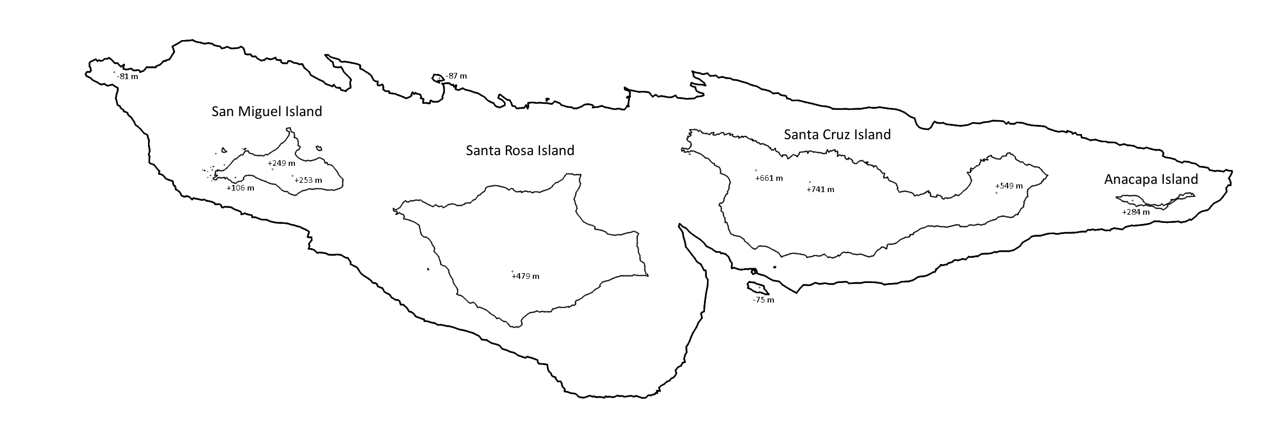
English: Approximate bathymetric map of the northern Channel Islands at their current sea level, as well as approximately 13,000 years ago when sea levels were 100 meters lower. At this point, all four islands were connected as a single large landmass, with some outlying minor islands just beyond. |
| Date | |
| Source | Own work |
| Author | Exoplanetaryscience |
Licensing
I, the copyright holder of this work, hereby publish it under the following license:
| This file is made available under the Creative Commons CC0 1.0 Universal Public Domain Dedication. | |
| The person who associated a work with this deed has dedicated the work to the
public domain by waiving all of their rights to the work worldwide under copyright law, including all related and neighboring rights, to the extent allowed by law. You can copy, modify, distribute and perform the work, even for commercial purposes, all without asking permission.
|
File history
Click on a date/time to view the file as it appeared at that time.
| Date/Time | Thumbnail | Dimensions | User | Comment | |
|---|---|---|---|---|---|
| current | 20:23, 26 November 2018 |
| 2,462 × 845 (7.95 MB) | Exoplanetaryscience | User created page with UploadWizard |
File usage
The following pages on the English Wikipedia use this file (pages on other projects are not listed):