
Size of this preview:
800 × 500 pixels. Other resolutions:
320 × 200 pixels |
640 × 400 pixels |
1,024 × 640 pixels |
1,280 × 800 pixels |
2,560 × 1,600 pixels |
9,277 × 5,798 pixels.
Original file (9,277 × 5,798 pixels, file size: 45.67 MB, MIME type: image/jpeg)
| This is a file from the
Wikimedia Commons. Information from its
description page there is shown below. Commons is a freely licensed media file repository. You can help. |
Summary
| Description |
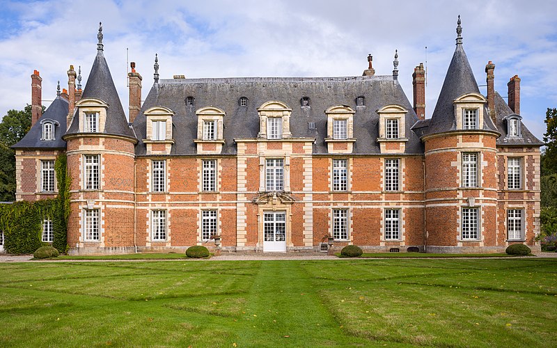
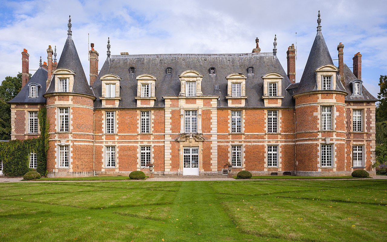
Français : La façade sud du château de Miromesnil en Seine-Maritime, dans le style Henri IV. Le monument historique fut construit entre 1590 et 1600 environ par Jean Dyel. Il est le lieu de naissance de Guy de Maupassant qui y naquit le 5 août 1850. English: The southern facade of the castle of Miromesnil in Seine-Maritime, in the Henri IV style. The historical monument was built between 1590 and 1600 by Jean Dyel. It is the birthplace of Guy de Maupassant who was born there on August 5, 1850. |
|||||||||||||||||||||||
| Date | ||||||||||||||||||||||||
| Source | Own work | |||||||||||||||||||||||
| Author |
|
|||||||||||||||||||||||
| Attribution ( required by the license) | © Frank Schulenburg / | |||||||||||||||||||||||

| Camera location |
| View this and other nearby images on: OpenStreetMap |
|
|---|
Assessment
|
Licensing
I, the copyright holder of this work, hereby publish it under the following license:
This file is licensed under the
Creative Commons
Attribution-Share Alike 4.0 International license.
- You are free:
- to share – to copy, distribute and transmit the work
- to remix – to adapt the work
- Under the following conditions:
- attribution – You must give appropriate credit, provide a link to the license, and indicate if changes were made. You may do so in any reasonable manner, but not in any way that suggests the licensor endorses you or your use.
- share alike – If you remix, transform, or build upon the material, you must distribute your contributions under the same or compatible license as the original.
File history
Click on a date/time to view the file as it appeared at that time.
| Date/Time | Thumbnail | Dimensions | User | Comment | |
|---|---|---|---|---|---|
| current | 16:07, 25 September 2022 |
| 9,277 × 5,798 (45.67 MB) | Frank Schulenburg | Slightly less saturation |
| 16:03, 25 September 2022 |
 | 9,277 × 5,798 (46.23 MB) | Frank Schulenburg | Uploaded own work with UploadWizard |
File usage
The following pages on the English Wikipedia use this file (pages on other projects are not listed):
Global file usage
The following other wikis use this file:
- Usage on de.wikipedia.org
- Usage on fi.wikipedia.org
- Usage on fr.wikipedia.org
- Usage on fy.wikipedia.org
- Usage on nl.wikipedia.org
- Usage on www.wikidata.org