No higher resolution available.
Central_Europe_Katzenstein.png (800 × 588 pixels, file size: 133 KB, MIME type: image/png)
| This is a file from the
Wikimedia Commons. Information from its
description page there is shown below. Commons is a freely licensed media file repository. You can help. |
Summary
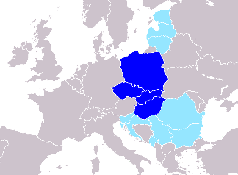
| Description |
English: Map of Central Europe according to
Peter J. Katzenstein, based on his book "Mitteleuropa: Between Europe and Germany",
ISBN
9781571811240 The Visegrád Group countries are referred to as Central Europe in the book countries for which there's no precise, uncontestable way to decide whether they are parts of Central Europe or not |
| Date | |
| Source | upload from English Wikipedia |
| Author | Squash Racket |
| Other versions | modified file:Map of Visegrad Group.png |
Licensing
I, the copyright holder of this work, hereby publish it under the following licenses:
This file is licensed under the
Creative Commons
Attribution-Share Alike 3.0 Unported license.
- You are free:
- to share – to copy, distribute and transmit the work
- to remix – to adapt the work
- Under the following conditions:
- attribution – You must give appropriate credit, provide a link to the license, and indicate if changes were made. You may do so in any reasonable manner, but not in any way that suggests the licensor endorses you or your use.
- share alike – If you remix, transform, or build upon the material, you must distribute your contributions under the same or compatible license as the original.

|
Permission is granted to copy, distribute and/or modify this document under the terms of the GNU Free Documentation License, Version 1.2 or any later version published by the Free Software Foundation; with no Invariant Sections, no Front-Cover Texts, and no Back-Cover Texts. A copy of the license is included in the section entitled GNU Free Documentation License. |
You may select the license of your choice.
The original description page was
here. All following user names refer to en.wikipedia.
- 2009-05-05 05:37 Squash Racket 1059×778× (30271 bytes) change colors
- 2009-05-05 04:47 Squash Racket 1059×778× (30488 bytes) {{Information |Description = Map of Central Europe according to [[Philip. J. Katzenstein]] |Source = own work, based on book "Mitteleuropa: Between Europe and Germany", {{ISBN|9781571811240}}. |Date = 2009-05-04 |Author = User
File history
Click on a date/time to view the file as it appeared at that time.
| Date/Time | Thumbnail | Dimensions | User | Comment | |
|---|---|---|---|---|---|
| current | 17:21, 15 December 2014 |
| 800 × 588 (133 KB) | OgreBot | (BOT): Reverting to most recent version before archival |
| 17:21, 15 December 2014 |
 | 1,059 × 778 (30 KB) | OgreBot | (BOT): Uploading old version of file from en.wikipedia; originally uploaded on 2009-05-05 05:37:29 by Squash Racket | |
| 17:21, 15 December 2014 |
 | 1,059 × 778 (30 KB) | OgreBot | (BOT): Uploading old version of file from en.wikipedia; originally uploaded on 2009-05-05 04:47:16 by Squash Racket | |
| 11:19, 29 May 2009 |
 | 800 × 588 (133 KB) | Upload1 | {{Information |Description={{en|1=Map of Central Europe according to Peter J. Katzenstein, based on his book "Mitteleuropa: Between Europe and Germany", ISBN 9781571811240}} |Source=upload from English Wikipedia |Author=Squash |
File usage
The following pages on the English Wikipedia use this file (pages on other projects are not listed):
Global file usage
The following other wikis use this file:
- Usage on el.wikipedia.org
- Usage on fa.wikipedia.org
- Usage on fy.wikipedia.org
- Usage on it.wikipedia.org
- Usage on sl.wikipedia.org
- Usage on th.wikipedia.org