Size of this preview:
800 × 470 pixels. Other resolutions:
320 × 188 pixels |
640 × 376 pixels |
1,024 × 602 pixels |
1,280 × 752 pixels |
2,560 × 1,505 pixels |
3,840 × 2,257 pixels.
Original file (3,840 × 2,257 pixels, file size: 4.42 MB, MIME type: image/jpeg)
| This is a file from the
Wikimedia Commons. Information from its
description page there is shown below. Commons is a freely licensed media file repository. You can help. |
Summary
| Description |
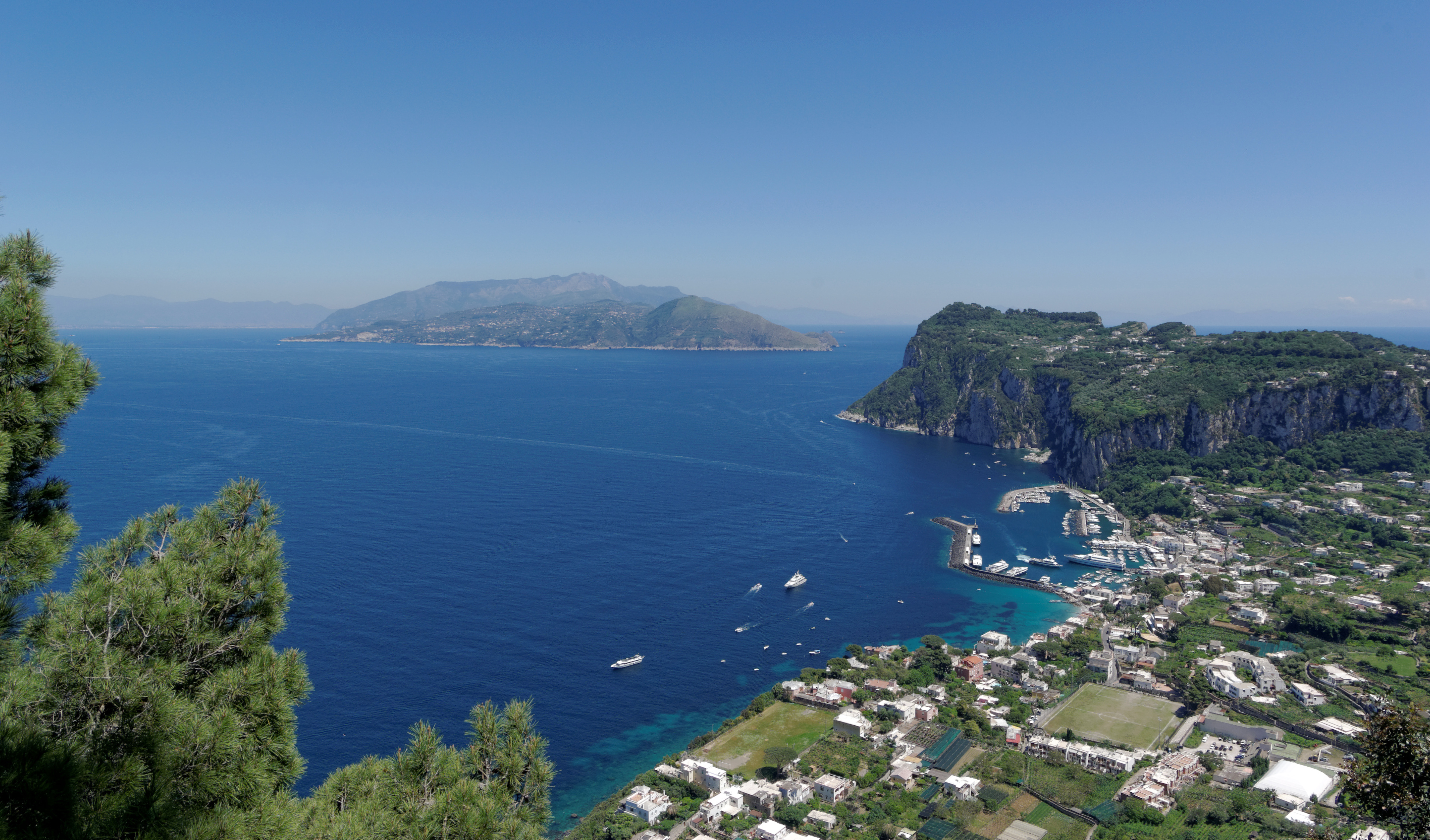
Deutsch: Anacapri, Villa San Michele, Blick nach Marina Grande
English: Anacapri, Villa San Michele, view to Marina Grande
Español: Vista del puerto de Marina Grande desde Villa San Michele en
Anacapri,
isla de Capri, Italia.
Français : Vue sur le port de Marina Grande depuis la
Villa San Michele à Anacapri, dans l'île de Capri, en Italie.
Magyar: A Marina Grande látképe
Anacapri községben a
Villa San Michele felől
Olaszország
Capri szigetén
Italiano: Panorama di Marina Grande, il principale porto dell'isola di
Capri, visto da
Villa San Michele.
|
| Date | |
| Source | Own work |
| Author | Berthold Werner |
| Camera location |
| View this and other nearby images on: OpenStreetMap |
|
|---|
|
This image was selected as
picture of the day on Wikimedia Commons for
13 February 2015. It was captioned as follows: Other languages:
Español: Vista del puerto de Marina Grande desde Villa San Michele en
Anacapri,
isla de Capri, Italia. Français : Vue sur le port de Marina Grande depuis la
Villa San Michele à Anacapri, dans l'île de Capri, en Italie. Italiano: Panorama di Marina Grande, il principale porto dell'isola di
Capri, visto da
Villa San Michele. Magyar: A Marina Grande látképe
Anacapri községben a
Villa San Michele felől
Olaszország
Capri szigetén |
Licensing
This file is licensed under the
Creative Commons
Attribution-Share Alike 3.0 Unported license.
Attribution: Berthold Werner
- You are free:
- to share – to copy, distribute and transmit the work
- to remix – to adapt the work
- Under the following conditions:
- attribution – You must give appropriate credit, provide a link to the license, and indicate if changes were made. You may do so in any reasonable manner, but not in any way that suggests the licensor endorses you or your use.
- share alike – If you remix, transform, or build upon the material, you must distribute your contributions under the same or compatible license as the original.
File history
Click on a date/time to view the file as it appeared at that time.
| Date/Time | Thumbnail | Dimensions | User | Comment | |
|---|---|---|---|---|---|
| current | 06:24, 4 April 2014 |
| 3,840 × 2,257 (4.42 MB) | Berthold Werner | more dust removed |
| 14:36, 2 April 2014 |
 | 3,840 × 2,257 (4.84 MB) | Berthold Werner | dustspot removed, sky partly cropped | |
| 15:21, 23 January 2014 |
 | 3,850 × 2,560 (4.45 MB) | Berthold Werner | VicuñaUploader 1.20 |
File usage
The following pages on the English Wikipedia use this file (pages on other projects are not listed):
Global file usage
The following other wikis use this file:
- Usage on ar.wikipedia.org
- Usage on be-tarask.wikipedia.org
- Usage on be.wikipedia.org
- Usage on bn.wikipedia.org
- Usage on ca.wikipedia.org
- Usage on ceb.wikipedia.org
- Usage on ce.wikipedia.org
- Usage on crh.wikipedia.org
- Usage on cs.wikipedia.org
- Usage on cv.wikipedia.org
- Usage on de.wikipedia.org
- Usage on diq.wikipedia.org
- Usage on en.wikivoyage.org
- Usage on eo.wikipedia.org
- Usage on es.wikipedia.org
- Usage on eu.wikipedia.org
- Usage on fa.wikipedia.org
- Usage on fr.wikipedia.org
- Usage on fr.wikivoyage.org
- Usage on ga.wikipedia.org
- Usage on gl.wikipedia.org
- Usage on he.wikipedia.org
- Usage on he.wikivoyage.org
- Usage on hr.wikipedia.org
- Usage on hsb.wikipedia.org
- Usage on hu.wikipedia.org
- Usage on hy.wikipedia.org
View more global usage of this file.