
Size of this preview:
450 × 600 pixels. Other resolutions:
180 × 240 pixels |
360 × 480 pixels |
576 × 768 pixels |
768 × 1,024 pixels |
2,448 × 3,264 pixels.
Original file (2,448 × 3,264 pixels, file size: 4.73 MB, MIME type: image/jpeg)
| This is a file from the
Wikimedia Commons. Information from its
description page there is shown below. Commons is a freely licensed media file repository. You can help. |
Summary
| Description |
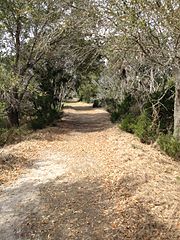
English: A view along the nature trail on Capers Island. |
| Date | 27 August 2014 (original upload date) |
| Source | Transferred from en.wikipedia to Commons. |
| Author | Cantbeatpie at English Wikipedia |
| Camera location | | View this and other nearby images on: OpenStreetMap |
|
|---|
Licensing
I, the copyright holder of this work, hereby publish it under the following license:

|
Permission is granted to copy, distribute and/or modify this document under the terms of the GNU Free Documentation License, Version 1.2 or any later version published by the Free Software Foundation; with no Invariant Sections, no Front-Cover Texts, and no Back-Cover Texts. A copy of the license is included in the section entitled GNU Free Documentation License. |
Original upload log
The original description page was
here. All following user names refer to en.wikipedia.
| Date/Time | Dimensions | User | Comment |
|---|---|---|---|
| 2014-08-27 20:01 | 2448×3264× (4957673 bytes) | Cantbeatpie | {{GFDL-self}} A view along the nature trail on Capers Island. |
File history
Click on a date/time to view the file as it appeared at that time.
| Date/Time | Thumbnail | Dimensions | User | Comment | |
|---|---|---|---|---|---|
| current | 06:23, 21 March 2016 |
| 2,448 × 3,264 (4.73 MB) | FastilyClone | Transferred from enwp |
File usage
The following pages on the English Wikipedia use this file (pages on other projects are not listed):