
Size of this preview:
800 × 600 pixels. Other resolutions:
320 × 240 pixels |
640 × 480 pixels |
1,024 × 768 pixels |
1,280 × 960 pixels |
2,560 × 1,920 pixels |
4,000 × 3,000 pixels.
Original file (4,000 × 3,000 pixels, file size: 1.66 MB, MIME type: image/jpeg)
| This is a file from the
Wikimedia Commons. Information from its
description page there is shown below. Commons is a freely licensed media file repository. You can help. |
Summary
| Description |
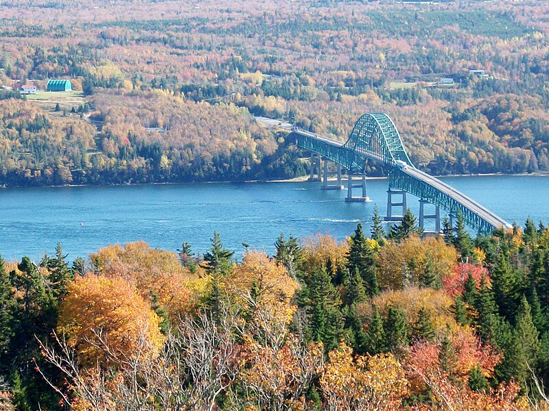
English: The Seal Island Bridge, the largest bridge on
Cape Breton Island, connects the more urban and populated Cape Breton Regional Municipality on the eastern side of the Island, to the rural Victoria County (the boundary is just to the east of the bridge). It is located below Kelly's Mountain on the Trans Canada Highway and spans the Great Bras d'Or channel of the Bras d'Or Lake. It is the 3rd longest bridge in Nova Scotia.
[1] |
| Date | |
| Source | Own work |
| Author | Grmike |
| Camera location | | View this and other nearby images on: OpenStreetMap |
|
|---|
Licensing
I, the copyright holder of this work, hereby publish it under the following license:
This file is licensed under the
Creative Commons
Attribution-Share Alike 3.0 Unported license.
- You are free:
- to share – to copy, distribute and transmit the work
- to remix – to adapt the work
- Under the following conditions:
- attribution – You must give appropriate credit, provide a link to the license, and indicate if changes were made. You may do so in any reasonable manner, but not in any way that suggests the licensor endorses you or your use.
- share alike – If you remix, transform, or build upon the material, you must distribute your contributions under the same or compatible license as the original.
File history
Click on a date/time to view the file as it appeared at that time.
| Date/Time | Thumbnail | Dimensions | User | Comment | |
|---|---|---|---|---|---|
| current | 21:37, 23 May 2013 |
| 4,000 × 3,000 (1.66 MB) | Ken Heaton | Tweaked contrast and hue of existing file a bit for clarity. |
| 21:36, 23 May 2013 |
 | 4,000 × 3,000 (1.71 MB) | Ken Heaton | Reverted to version as of 15:04, 22 October 2010 | |
| 21:33, 23 May 2013 |
 | 1,280 × 960 (354 KB) | Ken Heaton | Tweaked contrast and hue a bit for clarity. | |
| 15:04, 22 October 2010 |
 | 4,000 × 3,000 (1.71 MB) | Grmike | {{Information |Description={{en|1=the largest bridge that connects mainland Cape Breton with the rest of Nova Scotia.}} |Source={{own}} |Author= Grmike |Date=2010-10-20 |Permission= |other_versions= }} The second bridge passed to get to Cap |
File usage
The following pages on the English Wikipedia use this file (pages on other projects are not listed):
Global file usage
The following other wikis use this file:
- Usage on fa.wikipedia.org
- Usage on nl.wikipedia.org
- Usage on ru.wikipedia.org
- Usage on uk.wikipedia.org
- Usage on uz.wikipedia.org
- Usage on vi.wikipedia.org