Size of this preview:
732 × 600 pixels. Other resolutions:
293 × 240 pixels |
586 × 480 pixels |
852 × 698 pixels.
Original file (852 × 698 pixels, file size: 140 KB, MIME type: image/png)
| This is a file from the
Wikimedia Commons. Information from its
description page there is shown below. Commons is a freely licensed media file repository. You can help. |

|
This map image could be re-created using
vector graphics as an
SVG file. This has several advantages; see
Commons:Media for cleanup for more information. If an SVG form of this image is available, please upload it and afterwards replace this template with
{{
vector version available|new image name}}
.
It is recommended to name the SVG file “Canada-provinces layout.svg”—then the template Vector version available (or Vva) does not need the new image name parameter. |
Summary
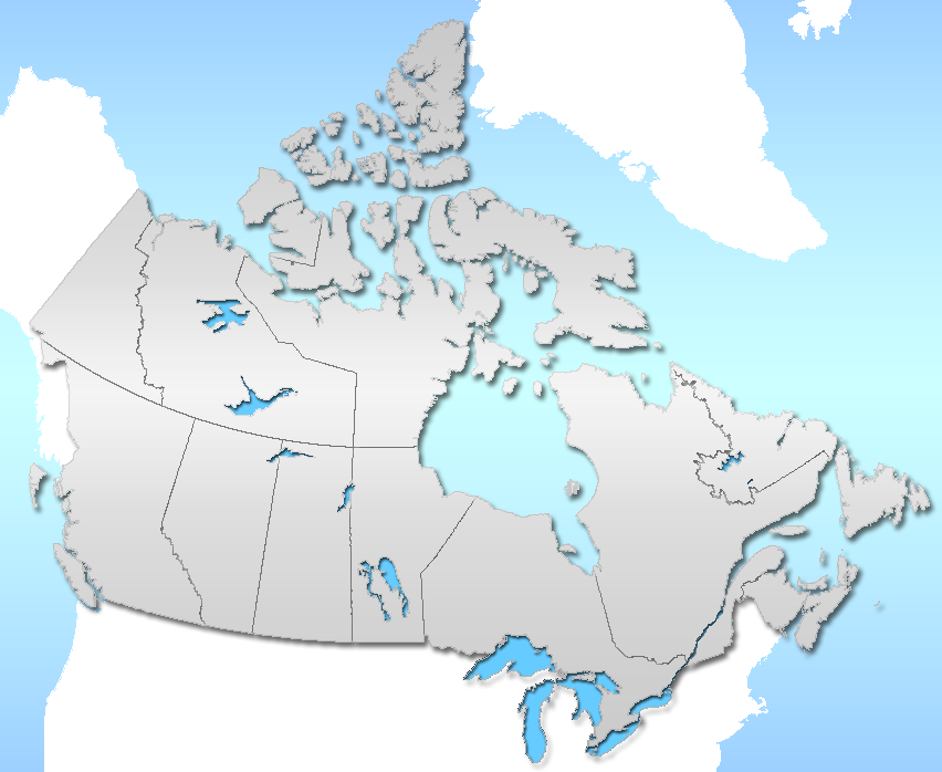
| Description | Province layout of Canada |
| Date | |
| Source | Self from GIS data / Photoshop |
| Author | Qyd |
| Permission ( Reusing this file) |
All |
Licensing
| I, the copyright holder of this work, release this work into the
public domain. This applies worldwide. In some countries this may not be legally possible; if so: I grant anyone the right to use this work for any purpose, without any conditions, unless such conditions are required by law. |
File history
Click on a date/time to view the file as it appeared at that time.
| Date/Time | Thumbnail | Dimensions | User | Comment | |
|---|---|---|---|---|---|
| current | 00:33, 10 December 2006 |
| 852 × 698 (140 KB) | Qyd | wash out colors |
| 06:47, 28 May 2006 |
 | 852 × 698 (223 KB) | Qyd | ||
| 05:35, 28 May 2006 |
 | 852 × 698 (200 KB) | Qyd | {{Information |Description=Province layout of Canada |Source=Self from GIS data / Photoshop |Date=May 2006 |Author= Qyd |Permission=All |other_versions= }} |
File usage
The following pages on the English Wikipedia use this file (pages on other projects are not listed):
- Wikipedia:Featured and good topic candidates/Featured log/December 2008
- Wikipedia:Featured and good topic candidates/Lists of universities in Canada
- Wikipedia:Featured and good topic removal candidates/2009 log
- Wikipedia:Featured and good topic removal candidates/Lists of universities in Canada/archive1
- Wikipedia:Featured topics/Lists of universities in Canada
- Wikipedia:Former featured and good topics
- Wikipedia:Wikipedia Signpost/2009-01-03/Dispatches
- Wikipedia talk:Wikipedia Signpost/2009-01-03/Dispatches
- Category:File-Class Canadian communities articles
Global file usage
The following other wikis use this file:
- Usage on ar.wikipedia.org
- Usage on bn.wikipedia.org
- Usage on ckb.wikipedia.org
- Usage on de.wikipedia.org
- Usage on es.wikipedia.org
- Usage on fa.wikipedia.org
- کانادا
- الگو:زیربخشهای آلبرتا
- الگو:روی نقشه استانهای کانادا
- الگو:نقشه استانهای کانادا
- الگو:Alberta
- الگو:زیربخشهای نواحی شمال غرب
- الگو:نوناووت
- الگو:Quebec
- الگو:زیربخشهای یوکان
- الگو:Alberta/توضیحات
- الگو:Manitoba/توضیحات
- الگو:Northwest Territories/توضیحات
- الگو:Nunavut/توضیحات
- الگو:Quebec/توضیحات
- الگو:Yukon/توضیحات
- رئوس مطالب کانادا
- الگو:زیربخشهای ساسکاچوان
- الگو:زیربخشهای انتاریو
- الگو:زیربخشهای بریتیش کلمبیا
- الگو:زیربخشهای بریتیش کلمبیا/توضیحات
- الگو:زیربخشهای یوکان/توضیحات
- الگو:زیربخشهای آلبرتا/توضیحات
- الگو:زیربخشهای نواحی شمال غرب/توضیحات
- الگو:زیربخشهای جزیره پرنس ادوارد
- الگو:زیربخشهای جزیره پرنس ادوارد/توضیحات
- الگو:زیربخشهای نیوفاندلند و لابرادور
- الگو:زیربخشهای نیوفاندلند و لابرادور/توضیحات
- الگو:زیربخشهای نوا اسکوشیا
- الگو:زیربخشهای نوا اسکوشیا/توضیحات
- الگو:نوناووت/توضیحات
- الگو:زیربخشهای نیوبرانزویک
- الگو:زیربخشهای نیوبرانزویک/توضیحات
- الگو:زیربخشهای ساسکاچوان/توضیحات
- الگو:زیربخشهای انتاریو/توضیحات
- سیاست در کانادا
- Usage on fo.wikipedia.org
- Usage on gl.wikipedia.org
- Usage on hi.wikipedia.org
- Usage on hr.wikipedia.org
- Usage on hsb.wikipedia.org
- Usage on hu.wikipedia.org
View more global usage of this file.