Size of this preview:
707 × 600 pixels. Other resolutions:
283 × 240 pixels |
566 × 480 pixels |
906 × 768 pixels |
1,192 × 1,011 pixels.
Original file (1,192 × 1,011 pixels, file size: 155 KB, MIME type: image/png)
File history
Click on a date/time to view the file as it appeared at that time.
| Date/Time | Thumbnail | Dimensions | User | Comment | |
|---|---|---|---|---|---|
| current | 15:41, 25 July 2010 |
 | 1,192 × 1,011 (155 KB) | Ras67 | cropped and crushed |
| 05:31, 14 April 2009 |
 | 1,200 × 1,019 (233 KB) | Lencer | + add some infos | |
| 17:59, 8 April 2009 |
 | 1,200 × 1,092 (229 KB) | Lencer | Ozean => Ocean | |
| 12:19, 8 April 2009 |
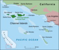
 | 1,200 × 1,092 (228 KB) | Lencer | {{Information| |Description=Map of Channel Islands near California |Source=own work, used: * Google Earth * USA California location map.svg by User:NordNordWest for Minimap * Idea: [[:de:Datei:Californian Chan |
File usage
The following pages on the English Wikipedia use this file (pages on other projects are not listed):
- Anacapa Island
- Anacapa State Marine Reserve
- Avalon, California
- Begg Rock
- Camp Cherry Valley
- Catalina Airport
- Channel Islands (California)
- Channel Islands National Park
- Hamilton Cove Seaplane Base
- Juana Maria
- Naples Reef
- National parks in California
- San Clemente Island
- San Miguel Island
- San Nicolas Island
- Santa Barbara Island
- Santa Catalina Island (California)
- Santa Cruz Island
- Santa Rosa Island (California)
- Santa Rosae
- Sinking of MV Conception
- Sutil Island
- Two Harbors, California
- Template:Channel Islands of California
- Category:Santa Catalina Island (California)
- Module:Location map/data/USA California Channel Islands
- Module:Location map/data/USA California Channel Islands/doc
Global file usage
The following other wikis use this file:
- Usage on ar.wikipedia.org
- Usage on arz.wikipedia.org
- Usage on ban.wikipedia.org
- Usage on bg.wikipedia.org
- Usage on ca.wikipedia.org
- Usage on cr.wikipedia.org
- Usage on cs.wikipedia.org
- Usage on da.wikipedia.org
- Usage on de.wikipedia.org
- Usage on eo.wikipedia.org
- Usage on es.wikipedia.org
- Usage on et.wikipedia.org
- Usage on eu.wikipedia.org
- Usage on fa.wikipedia.org
- Usage on fi.wikipedia.org
- Usage on fr.wikipedia.org
- Usage on gl.wikipedia.org
View more global usage of this file.

