
Size of this preview:
800 × 551 pixels. Other resolutions:
320 × 220 pixels |
640 × 441 pixels |
1,024 × 705 pixels |
1,280 × 882 pixels |
2,757 × 1,899 pixels.
Original file (2,757 × 1,899 pixels, file size: 1.3 MB, MIME type: image/jpeg)
| This is a file from the
Wikimedia Commons. Information from its
description page there is shown below. Commons is a freely licensed media file repository. You can help. |
.jpg)
Summary
| Description |
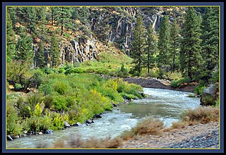
Floriston was first settled at the bottom of Bronco Creek as a railroad construction camp in 1867. It was later named Bronco, and also known as Wickes. The Wickes brothers operated a wood cutting business up Bronco Creek in the 1870's and 1880's. In 1891 the Floriston Ice Company built an ice pond and icehouse in the area. Two small sawmills were built up Bronco Creek about that time. In 1900 the Floriston Pulp and Paper Mill was built where Interstate 80 now passes across the river from the town of Floriston . The existing town of Floriston was a company built and operated town, with most of houses constructed in 1900. The paper company operated its own flumes, an aerial tramway in Coldstream Valley , and its own railroad up Alder Creek and into Euer Valley in the late 1920's. Due the acid pollution that the paper dumped into the river for 30 years, the paper mill closed in 1930. A Clamper's plaque is dedicated to this still visible landmark town.More.. <a href=" http://www.sierrasun.com/article/20071102/COMMUNITY01/71101014" rel="noreferrer nofollow">www.sierrasun.com/article/20071102/COMMUNITY01/71101014</a> |
| Date | |
| Source | California Zephyr at Floriston California |
| Author | Loco Steve from Bromley , UK |
| Camera location |
| View this and other nearby images on: OpenStreetMap |
|
|---|
.jpg¶ms=039.370767_N_-120.072283_E_globe:Earth_type:camera_source:Flickr_&language=en)
Licensing
This file is licensed under the
Creative Commons
Attribution 2.0 Generic license.
- You are free:
- to share – to copy, distribute and transmit the work
- to remix – to adapt the work
- Under the following conditions:
- attribution – You must give appropriate credit, provide a link to the license, and indicate if changes were made. You may do so in any reasonable manner, but not in any way that suggests the licensor endorses you or your use.
| This image was originally posted to Flickr by Loco Steve at https://flickr.com/photos/36989019@N08/5159049566. It was reviewed on 5 May 2020 by FlickreviewR 2 and was confirmed to be licensed under the terms of the cc-by-2.0. |

|
This media file is uncategorized.
Please help improve this media file by adding it to one or more categories, so it may be associated with related media files (
how?), and so that it can be more easily found.
Please notify the uploader with {{subst:Please link images|File:California Zephyr at Floriston California (5159049566).jpg}} ~~~~ |
File history
Click on a date/time to view the file as it appeared at that time.
| Date/Time | Thumbnail | Dimensions | User | Comment | |
|---|---|---|---|---|---|
| current | 01:56, 5 May 2020 |
| 2,757 × 1,899 (1.3 MB) | CactusJack | Transferred from Flickr via #flickr2commons |
File usage
The following pages on the English Wikipedia use this file (pages on other projects are not listed):
Global file usage
The following other wikis use this file:
- Usage on sr.wikipedia.org
.jpg)