
Size of this preview:
642 × 600 pixels. Other resolutions:
257 × 240 pixels |
514 × 480 pixels |
822 × 768 pixels |
1,096 × 1,024 pixels |
2,192 × 2,048 pixels |
2,756 × 2,575 pixels.
Original file (2,756 × 2,575 pixels, file size: 57 KB, MIME type: image/png)
| This is a file from the
Wikimedia Commons. Information from its
description page there is shown below. Commons is a freely licensed media file repository. You can help. |
Summary
| Description |
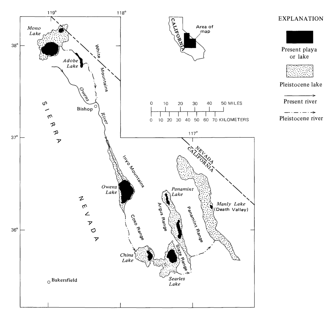
English: Map showing the system of once-interconnected Pleistocene lakes in eastern California (USGS) |
| Date | |
| Source | Subsurface stratigraphy and geochemistry of late Quaternary evaporites, Searles Lake, California, with a section on radiocarbon ages of stratigraphic units, USGS DOI: 10.3133/pp1043. Professional Paper 1043 |
| Author | George I Smith |
Licensing
This image is in the
public domain in the United States because it only contains materials that originally came from the
United States Geological Survey, an agency of the
United States Department of the Interior. For more information, see
the official USGS copyright policy.
|
File history
Click on a date/time to view the file as it appeared at that time.
| Date/Time | Thumbnail | Dimensions | User | Comment | |
|---|---|---|---|---|---|
| current | 22:24, 4 October 2015 |
| 2,756 × 2,575 (57 KB) | Plazak | User created page with UploadWizard |
File usage
The following pages on the English Wikipedia use this file (pages on other projects are not listed):
Global file usage
The following other wikis use this file:
- Usage on de.wikipedia.org
- Usage on fr.wikipedia.org
- Usage on he.wikipedia.org
- Usage on it.wikipedia.org
- Usage on pt.wikipedia.org
- Usage on ru.wikipedia.org