
Size of this PNG preview of this SVG file:
451 × 451 pixels. Other resolutions:
240 × 240 pixels |
480 × 480 pixels |
768 × 768 pixels |
1,024 × 1,024 pixels |
2,048 × 2,048 pixels.
Original file (SVG file, nominally 451 × 451 pixels, file size: 5 KB)
| This is a file from the
Wikimedia Commons. Information from its
description page there is shown below. Commons is a freely licensed media file repository. You can help. |
Summary
| Description |
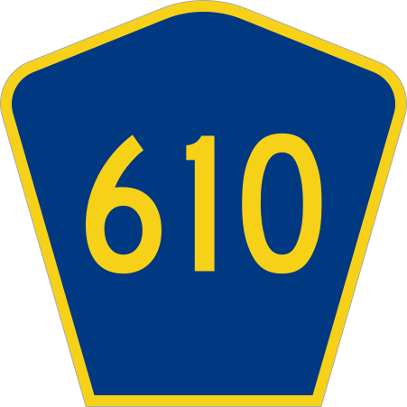
English: Diagram of a generic county route marker, intended to be used at small sizes as county names are not visible at 20 pixels. Loosely based on the standard county route marker (sign M1-6) from the
2012 supplement to the
2004 edition of Standard Highway Signs, which is public domain as part of the MUTCD. Uses the
Roadgeek 2005 fonts. (United States law does not permit the copyrighting of typeface designs, and the fonts are meant to be copies of a U.S. Government-produced work anyway.) |
| Date | |
| Source | Own work, based on File:CR 20 jct.svg by Fredddie |
| Author | TwinsMetsFan |
Licensing
This file is in the
public domain because it comes from the
Manual on Uniform Traffic Control Devices, sign number M1-6, which
states specifically on page I-1 that:
|
 |
File history
Click on a date/time to view the file as it appeared at that time.
| Date/Time | Thumbnail | Dimensions | User | Comment | |
|---|---|---|---|---|---|
| current | 02:59, 24 March 2012 |
| 451 × 451 (5 KB) | TwinsMetsFan |
File usage
The following pages on the English Wikipedia use this file (pages on other projects are not listed):
- County Route 532 (New Jersey)
- County Route 536 (New Jersey)
- Eisenhower Parkway
- Interstate 75 in Florida
- List of county roads in Manatee County, Florida
- List of county roads in Sarasota County, Florida
- List of county routes in Atlantic County, New Jersey
- List of county routes in Burlington County, New Jersey
- List of county routes in Camden County, New Jersey
- List of county routes in Cape May County, New Jersey
- List of county routes in Cumberland County, New Jersey
- List of county routes in Essex County, New Jersey
- List of county routes in Gloucester County, New Jersey
- List of county routes in Hudson County, New Jersey
- List of county routes in Hunterdon County, New Jersey
- List of county routes in Middlesex County, New Jersey
- List of county routes in Morris County, New Jersey
- List of county routes in Ocean County, New Jersey
- List of county routes in Passaic County, New Jersey
- List of county routes in Salem County, New Jersey
- List of county routes in Somerset County, New Jersey
- List of county routes in Sussex County, New Jersey
- List of county routes in Union County, New Jersey
- List of county routes in Warren County, New Jersey
- Manatee County, Florida
- New Jersey Route 59
- Talk:Lincoln Park/West Bergen
- Talk:West Side, Jersey City
- User:Editorofthewiki/List of major intersections on New Jersey Route 47
- User:Mattx8y/sandbox/MC CRs
- Wikipedia:WikiProject U.S. Roads/Redirects/Florida/County
Global file usage
The following other wikis use this file:
- Usage on bn.wikipedia.org
- Usage on fr.wikipedia.org