
Size of this PNG preview of this SVG file:
469 × 600 pixels. Other resolutions:
187 × 240 pixels |
375 × 480 pixels |
600 × 768 pixels |
800 × 1,024 pixels |
1,601 × 2,048 pixels |
512 × 655 pixels.
Original file (SVG file, nominally 512 × 655 pixels, file size: 345 KB)
| This is a file from the
Wikimedia Commons. Information from its
description page there is shown below. Commons is a freely licensed media file repository. You can help. |
Summary
| Description |
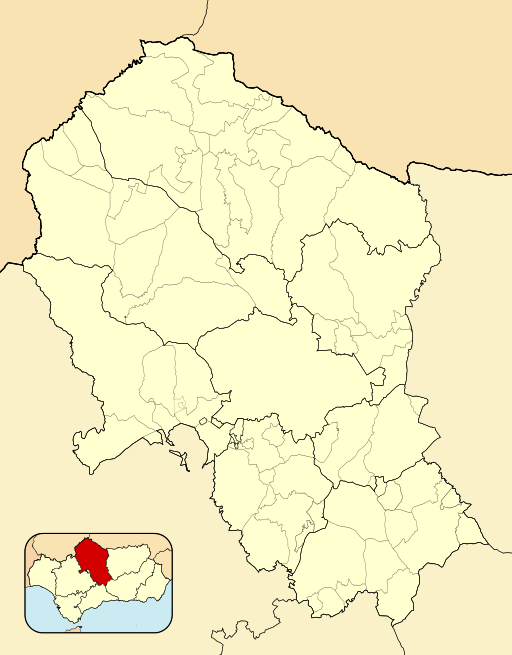
English: Location map of
Province of Córdoba
Equirectangular projection, N/S stretching 130 %. Geographic limits of the map:
Español: Mapa de localización de la
Provincia de Córdoba
Proyección equirrectangular (cilíndrica equidistante), N/S estirada 130 %. Límites geográficos del mapa:
|
|
| Date | ||
| Source | Own work based on: EspañaLoc.svg by HansenBCN | |
| Author | Miguillen | |
| SVG development |
|
Licensing
Miguillen, the copyright holder of this work, hereby publishes it under the following license:
This file is licensed under the
Creative Commons
Attribution-Share Alike 3.0 Unported license.
Attribution:
Miguillen
- You are free:
- to share – to copy, distribute and transmit the work
- to remix – to adapt the work
- Under the following conditions:
- attribution – You must give appropriate credit, provide a link to the license, and indicate if changes were made. You may do so in any reasonable manner, but not in any way that suggests the licensor endorses you or your use.
- share alike – If you remix, transform, or build upon the material, you must distribute your contributions under the same or compatible license as the original.
File history
Click on a date/time to view the file as it appeared at that time.
| Date/Time | Thumbnail | Dimensions | User | Comment | |
|---|---|---|---|---|---|
| current | 16:44, 9 December 2010 |
| 512 × 655 (345 KB) | Miguillen | colores y mosca según convención |
| 00:03, 12 November 2010 |
 | 512 × 655 (232 KB) | Miguillen | == {{int:filedesc}} == {{Information |Description={{en|Location map of Province of Córdoba}} Equirectangular projection, N/S stretching 130 %. Geographic limits of the map: * N: ° N * S: ° N * W: ° O * E: ° O {{es|Ma |
File usage
The following pages on the English Wikipedia use this file (pages on other projects are not listed):
Global file usage
The following other wikis use this file:
- Usage on ar.wikipedia.org
- Usage on ba.wikipedia.org
- Usage on ceb.wikipedia.org
- Usage on es.wikipedia.org
- Córdoba (España)
- Montoro
- Santaella
- Villafranca de Córdoba
- Cañete de las Torres
- Pedro Abad
- Cabra (Córdoba)
- La Carlota (España)
- Almedinilla
- Baena
- Almodóvar del Río
- Valenzuela (Córdoba)
- Lucena
- Aeropuerto de Córdoba (España)
- Villaralto
- Peñarroya-Pueblonuevo
- Montalbán de Córdoba
- Priego de Córdoba
- Iznájar
- Belmez
- Alcázar de los Reyes Cristianos
- Adamuz
- Cardeña (Córdoba)
- Azuel
- La Rambla (Córdoba)
- Fuente Obejuna
- Benamejí
- Añora
- Monturque
- Villaviciosa de Córdoba
- Villa del Río
- Pozoblanco
- Pedroche
- Hornachuelos
- Belalcázar
- Aguilar de la Frontera
- Alcaracejos
- Los Blázquez
- Bujalance
- Carcabuey
- El Carpio
- Castro del Río
- Conquista (Córdoba)
- Espiel
- Espejo (Córdoba)
- Encinas Reales
- Dos Torres
View more global usage of this file.