Size of this preview:
800 × 532 pixels. Other resolutions:
320 × 213 pixels |
640 × 426 pixels |
1,024 × 681 pixels |
1,280 × 851 pixels |
2,560 × 1,702 pixels |
6,016 × 4,000 pixels.
Original file (6,016 × 4,000 pixels, file size: 6.33 MB, MIME type: image/jpeg)
| This is a file from the
Wikimedia Commons. Information from its
description page there is shown below. Commons is a freely licensed media file repository. You can help. |
|
This is an image of a place or building that is listed on the
National Register of Historic Places in the
United States of America. Its reference number is
15001043. |
| Camera location |
| View this and other nearby images on: OpenStreetMap |
|
|---|
| Description |
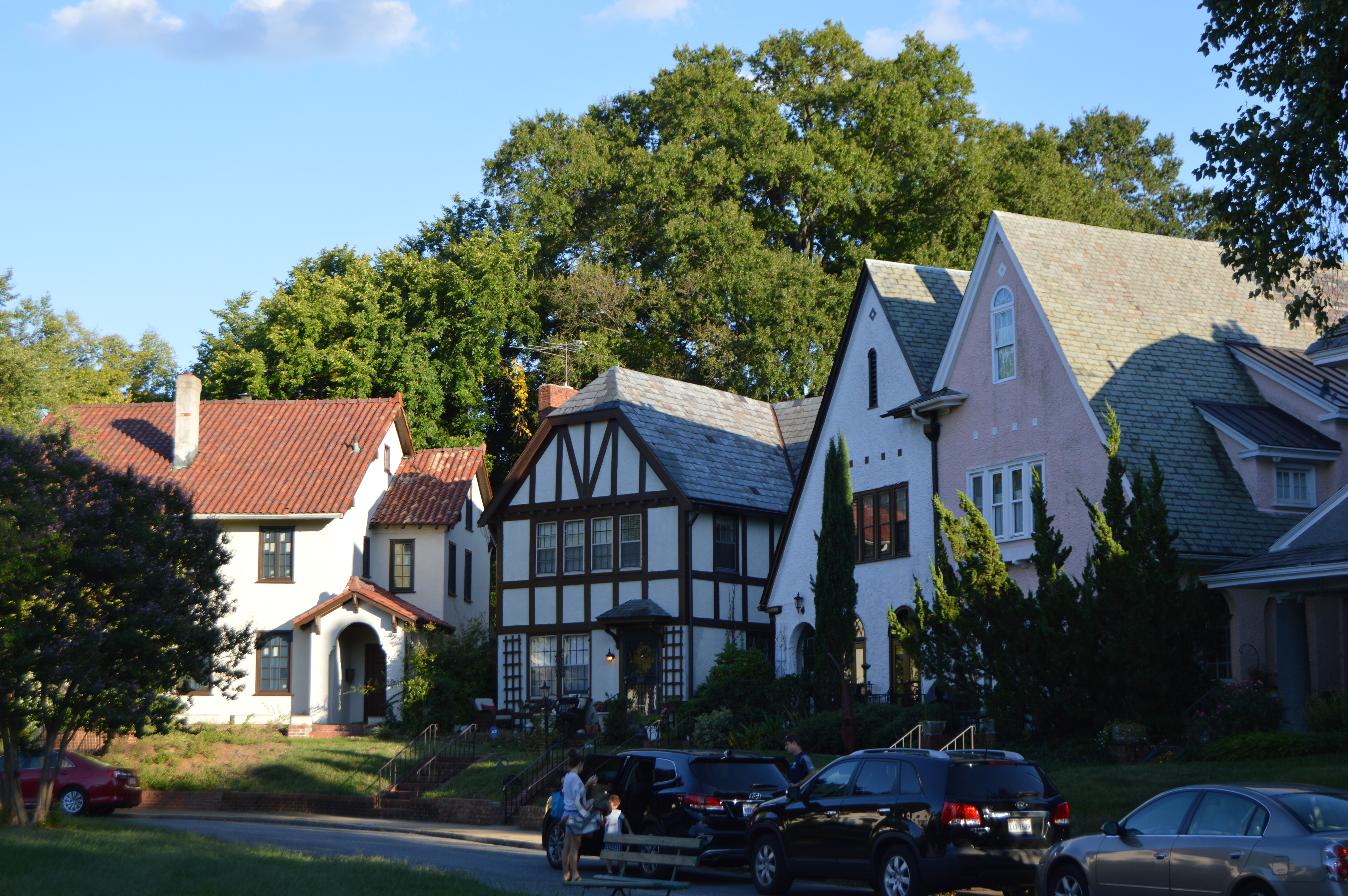
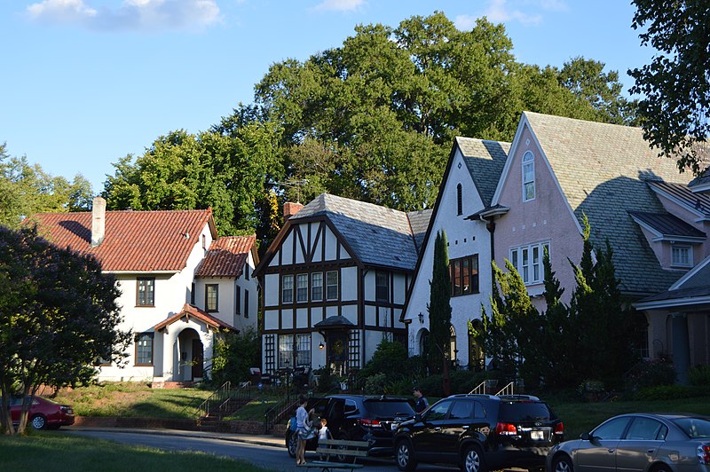
English: Houses on the southern side of
Byrd Park Court in
Richmond,
Virginia,
United States. The whole court is listed on the
National Register of Historic Places as a
historic district. |
||
| Date | Taken on 9 September 2017 | ||
| Source | Own work | ||
| Author | Nyttend | ||
| Permission ( Reusing this file) |
|
||
| Other versions | None |
File history
Click on a date/time to view the file as it appeared at that time.
| Date/Time | Thumbnail | Dimensions | User | Comment | |
|---|---|---|---|---|---|
| current | 02:59, 21 September 2017 |
| 6,016 × 4,000 (6.33 MB) | Nyttend | {{NRHP|15001043}} {{Location|37|32|36|N|77|28|3|W}} {{Information |Description={{en|Houses on the southern side of {{w|Byrd Park Court Historic District|Byrd Park Court}} in {{w|Richmond, Virginia|Richmond}}, {{w|Virginia}}, {{w|United States}}. The w... |
File usage
The following pages on the English Wikipedia use this file (pages on other projects are not listed):
Global file usage
The following other wikis use this file:
- Usage on www.wikidata.org