
Size of this preview:
800 × 600 pixels. Other resolutions:
320 × 240 pixels |
640 × 480 pixels |
1,024 × 768 pixels |
1,280 × 960 pixels |
2,560 × 1,920 pixels |
3,072 × 2,304 pixels.
Original file (3,072 × 2,304 pixels, file size: 1.14 MB, MIME type: image/jpeg)
| This is a file from the
Wikimedia Commons. Information from its
description page there is shown below. Commons is a freely licensed media file repository. You can help. |
Summary
| Description | |
| Date | |
| Source | Own work |
| Author | Michael Barera |
| Camera location |
| View this and other nearby images on: OpenStreetMap |
|
|---|
Licensing
I, the copyright holder of this work, hereby publish it under the following license:
This file is licensed under the
Creative Commons
Attribution-Share Alike 4.0 International license.
Attribution: Michael Barera
- You are free:
- to share – to copy, distribute and transmit the work
- to remix – to adapt the work
- Under the following conditions:
- attribution – You must give appropriate credit, provide a link to the license, and indicate if changes were made. You may do so in any reasonable manner, but not in any way that suggests the licensor endorses you or your use.
- share alike – If you remix, transform, or build upon the material, you must distribute your contributions under the same or compatible license as the original.
| Other available license options: | ||
|---|---|---|
I, the copyright holder of this work, hereby publish it under the following licenses: This file is licensed under the
Creative Commons
Attribution-Share Alike 3.0 Unported license. Attribution: Michael Barera
You may select the license of your choice. |

| Annotations | This image is annotated: View the annotations at Commons |
File history
Click on a date/time to view the file as it appeared at that time.
| Date/Time | Thumbnail | Dimensions | User | Comment | |
|---|---|---|---|---|---|
| current | 15:40, 30 August 2010 |
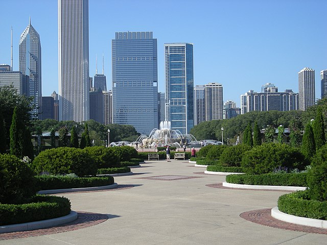
| 3,072 × 2,304 (1.14 MB) | TFCforever | {{Information |Description={{en|1=Buckingham Fountain in Grant Park in Chicago, photographed on August 27, 2010.}} |Source={{own}} |Author= TFCforever |Date=2010-08-27 |Permission= |other_versions= }} {{Location|41|52|32.9|N|87| |
File usage
The following pages on the English Wikipedia use this file (pages on other projects are not listed):
- 1991 Chicago Marathon
- 8th Street Fountain
- Abraham Lincoln: The Head of State
- Adler Planetarium
- Agora (sculpture)
- America's Courtyard
- Art Institute of Chicago
- BP Pedestrian Bridge
- Balbo Monument
- Big Beaver Totem Pole
- Bike the Drive
- Buckingham Fountain
- Bust of Georg Solti
- Chicago Blues Festival
- Chicago Jazz Festival
- Chicago Loop
- Chicago Marathon
- Chicago Stock Exchange Arch
- Cloud Gate
- Crown Fountain
- Cubi VII
- Field Museum of Natural History
- Flying Dragon (Calder)
- Fountain of the Great Lakes
- General John Logan Memorial
- Grant Park (Chicago)
- Grant Park Music Festival
- Grant Park Symphony Orchestra
- Historic Michigan Boulevard District
- Joseph Rosenberg Fountain
- Large Interior Form, 1953–54
- Lions (Kemeys)
- Lollapalooza
- Magdalene (sculpture)
- Maggie Daley Park
- Maggie Daley Park ice skating ribbon
- Man Enters the Cosmos
- Man with Fish
- Millennium Park
- Museum Campus
- Nichols Bridgeway
- Olmec Head, Number 8
- Petrillo Music Shell
- Roosevelt University
- Shedd Aquarium
- Soldier Field
- Spiral Galaxy (sculpture)
- Spirit of Music (sculpture)
- Statue of Christopher Columbus (Chicago)
- Taste of Chicago
- The Bowman and The Spearman
- Untitled (Wool)
- Template:Grant Park
Global file usage
The following other wikis use this file:
- Usage on af.wikipedia.org
- Usage on ca.wikipedia.org
- Usage on de.wikipedia.org
- Usage on fr.wikipedia.org
- Usage on hy.wikipedia.org
- Usage on ru.wikipedia.org