
Size of this preview:
696 × 600 pixels. Other resolutions:
279 × 240 pixels |
557 × 480 pixels |
891 × 768 pixels |
1,188 × 1,024 pixels |
1,822 × 1,570 pixels.
Original file (1,822 × 1,570 pixels, file size: 1.56 MB, MIME type: image/jpeg)
| This is a file from the
Wikimedia Commons. Information from its
description page there is shown below. Commons is a freely licensed media file repository. You can help. |
Summary
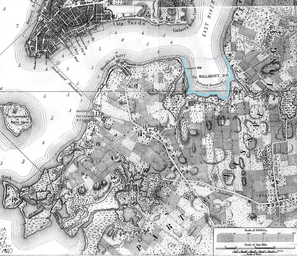
| Description | Map of Brooklyn, NY made in 1766, with Wallabout Bay outlines |
| Date | |
| Source | http://bklyn-genealogy-info.stevemorse.org/Map/1766.Vill.Bklyn.html |
| Author | Bernard Ratzer; marked by Beyond My Ken ( talk) 04:22, 5 July 2015 (UTC) |
| Other versions |
 |
Licensing
|
This work is in the public domain in its country of origin and other countries and areas where the copyright term is the author's life plus 100 years or fewer. | |
| This file has been identified as being free of known restrictions under copyright law, including all related and neighboring rights. | |
File history
Click on a date/time to view the file as it appeared at that time.
| Date/Time | Thumbnail | Dimensions | User | Comment | |
|---|---|---|---|---|---|
| current | 04:22, 5 July 2015 |
| 1,822 × 1,570 (1.56 MB) | Beyond My Ken | == {{int:filedesc}} == {{Information |Description= Map of Brooklyn, NY made in 1766, with Wallabout Bay outlines |Source= http://bklyn-genealogy-info.stevemorse.org/Map/1766.Vill.Bklyn.html |Date= 1766 |Author= Bernard Ratzer; marked by ~~~~ |Permissio... |
File usage
The following pages on the English Wikipedia use this file (pages on other projects are not listed):
Global file usage
The following other wikis use this file:
- Usage on de.wikipedia.org
- Usage on es.wikipedia.org