
Size of this preview:
800 × 533 pixels. Other resolutions:
320 × 213 pixels |
640 × 427 pixels |
1,024 × 683 pixels |
1,280 × 853 pixels |
2,560 × 1,706 pixels |
4,868 × 3,245 pixels.
Original file (4,868 × 3,245 pixels, file size: 6.17 MB, MIME type: image/jpeg)
| This is a file from the
Wikimedia Commons. Information from its
description page there is shown below. Commons is a freely licensed media file repository. You can help. |
Summary
| Description |
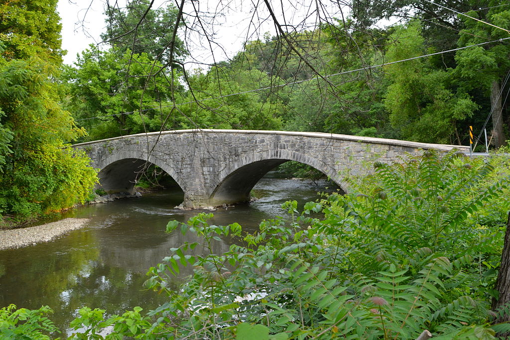
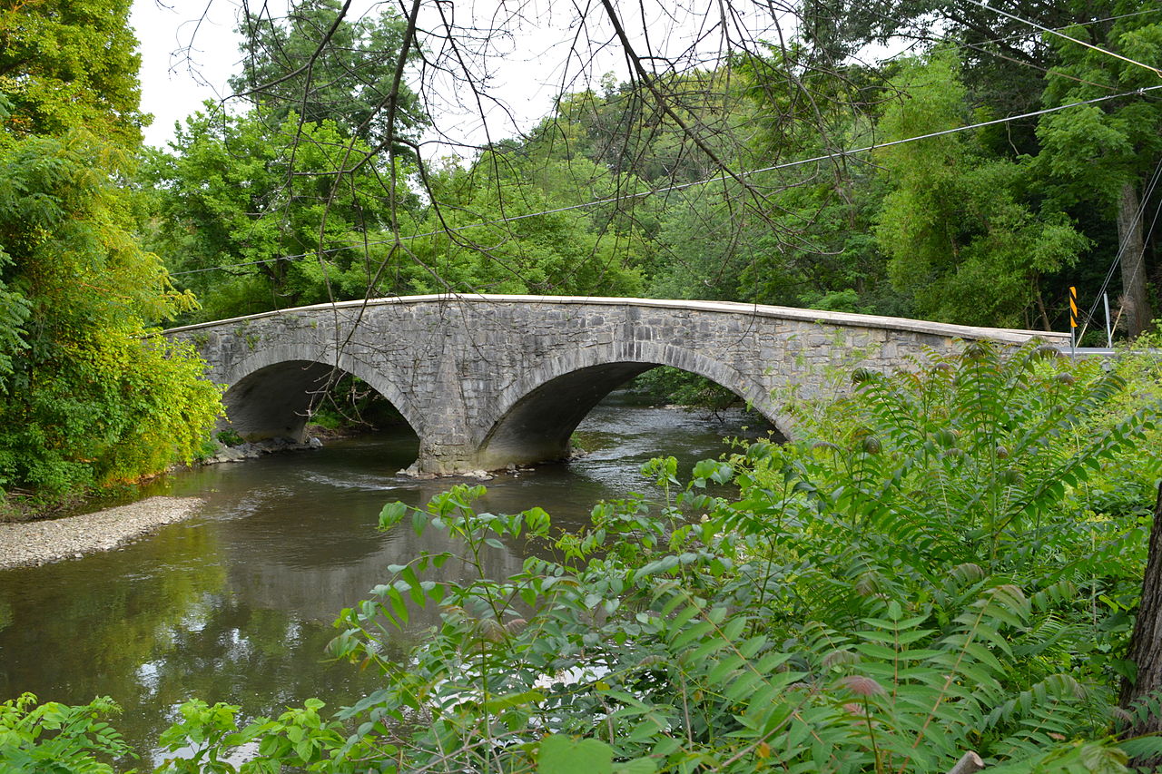
English: Bridge between Guilford and Hamilton Townships listed on the NRHP on June 22, 1988
(#88000776). On Legislative Route 28033 over Conococheague Creek near Social Island (Social Island Road) in Guilford and Hamilton Townships, Franklin County, Pennsylvania. |
| Date | |
| Source | Own work |
| Author | Smallbones |
| Camera location |
| View this and other nearby images on: OpenStreetMap |
|
|---|
|
This is an image of a place or building that is listed on the
National Register of Historic Places in the
United States of America. Its reference number is
88000776. |
Licensing
I, the copyright holder of this work, hereby publish it under the following license:
| This file is made available under the Creative Commons CC0 1.0 Universal Public Domain Dedication. | |
| The person who associated a work with this deed has dedicated the work to the
public domain by waiving all of their rights to the work worldwide under copyright law, including all related and neighboring rights, to the extent allowed by law. You can copy, modify, distribute and perform the work, even for commercial purposes, all without asking permission.
|
File history
Click on a date/time to view the file as it appeared at that time.
| Date/Time | Thumbnail | Dimensions | User | Comment | |
|---|---|---|---|---|---|
| current | 22:04, 7 July 2014 |
| 4,868 × 3,245 (6.17 MB) | Smallbones | User created page with UploadWizard |
File usage
The following pages on the English Wikipedia use this file (pages on other projects are not listed):
Global file usage
The following other wikis use this file:
- Usage on cy.wikipedia.org
- Usage on es.wikipedia.org
- Usage on fr.wikipedia.org
- Usage on tl.wikipedia.org
- Usage on uk.wikipedia.org
- Usage on ur.wikipedia.org
- Usage on vi.wikipedia.org
- Usage on www.wikidata.org