Size of this preview:
450 × 600 pixels. Other resolutions:
180 × 240 pixels |
360 × 480 pixels |
576 × 768 pixels |
768 × 1,024 pixels |
1,536 × 2,048 pixels |
3,000 × 4,000 pixels.
Original file (3,000 × 4,000 pixels, file size: 4.39 MB, MIME type: image/jpeg)
| This is a file from the
Wikimedia Commons. Information from its
description page there is shown below. Commons is a freely licensed media file repository. You can help. |
.jpg)
Summary
| Description |
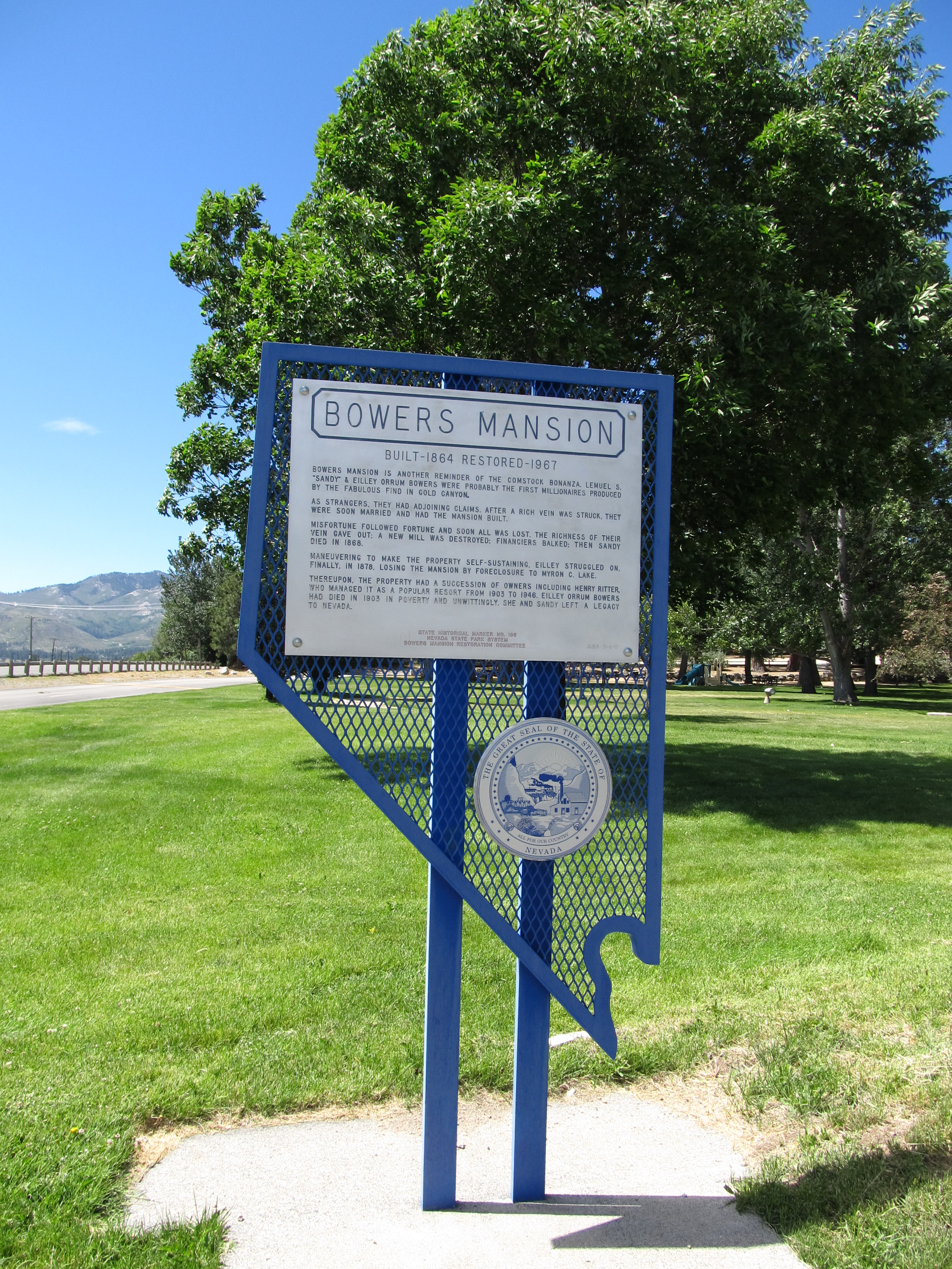
English: Bowers Mansion is another reminder of the Comstock bonanza. Lemuel S. "Sandy" and Eilley Orrum Bowers were probably the first millionaires produced by the fabulous find in Gold Canyon.
As strangers, they had adjoining claims. After a rich vein was struck, they were soon married and had the mansion built. Misfortune followed fortune and soon all was lost. The richness of their vein gave out; a new mill was destroyed; financiers balked. Then Sandy died in 1868. Maneuvering to make the property self-sustaining, Eilley struggled on, finally, in 1878, losing the mansion by foreclosure to Myron C. Lake. Thereupon, the property had a succession of owners including Henry Riter, who managed it as a popular resort from 1903 to 1946. Eilley Orrum Bowers had died in 1903, in poverty and unwittingly, she and Sandy left a legacy to Nevada. |
| Date | |
| Source | Bowers Mansion, Nevada Historical Marker No.166, Washoe Valley, Nevada |
| Author | Ken Lund from Reno, Nevada, USA |
| Camera location |
| View this and other nearby images on: OpenStreetMap |
|
|---|
.jpg¶ms=039.284805_N_-119.840959_E_globe:Earth_type:camera_source:Flickr_&language=en)
Licensing
This file is licensed under the
Creative Commons
Attribution-Share Alike 2.0 Generic license.
- You are free:
- to share – to copy, distribute and transmit the work
- to remix – to adapt the work
- Under the following conditions:
- attribution – You must give appropriate credit, provide a link to the license, and indicate if changes were made. You may do so in any reasonable manner, but not in any way that suggests the licensor endorses you or your use.
- share alike – If you remix, transform, or build upon the material, you must distribute your contributions under the same or compatible license as the original.
| This image was originally posted to Flickr by Ken Lund at https://flickr.com/photos/75683070@N00/7425816234. It was reviewed on 5 December 2015 by FlickreviewR and was confirmed to be licensed under the terms of the cc-by-sa-2.0. |
File history
Click on a date/time to view the file as it appeared at that time.
| Date/Time | Thumbnail | Dimensions | User | Comment | |
|---|---|---|---|---|---|
| current | 22:01, 5 December 2015 |
| 3,000 × 4,000 (4.39 MB) | INeverCry | Transferred from Flickr via Flickr2Commons |
File usage
The following pages on the English Wikipedia use this file (pages on other projects are not listed):
.jpg)